Curated by PaddleWays
Route
- Distance
- 0.9 mi
- Paddle time
- ~0.5 hrs
- Put-in & take-out
- Longboat Key Overlook Park - Paddlecraft Access
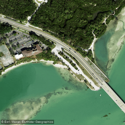
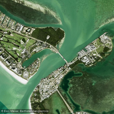
New Pass is a coastal inlet connecting the Gulf of Mexico to Sarasota Bay on Florida's west coast, located between Lido Key to the south and Longboat Key to the north. The primary paddling launch point for this area is Ken Thompson Park on City Island, which offers a dedicated kayak launch with ample parking and restrooms. From this launch, a short paddle of half a mile to one mile leads to a notable sandbar on the Longboat Key side of New Pass, which is only accessible by water and is most exposed during low to mid tide. The pass itself is characterized by significant tidal currents and heavy boat traffic, requiring paddlers to use a proper anchor and anchor trolley if stopping. The channel through the pass is constantly shifting, with depths ranging from four to seven feet, and is marked by frequently moved, uncharted aids to navigation. The New Pass Bascule Bridge spans the inlet with a closed vertical clearance of 23 feet. Paddling in the open waters of Sarasota Bay is subject to wind and tide, and conditions can become rough with exposure. The surrounding area features views of the Ringling Bridge and provides access to the Lido mangrove tunnels. The historic New Pass Grill & Bait Shop, a waterfront landmark since 1929, is located on the pass. Wildlife sightings in the bay can include dolphins, birds, and manatees.
Curated routes
Hand-picked by the PaddleWays team, with put-ins, take-outs, paddle times and the hazards along the way.
Route
Hazards
No hazards are marked on New Pass yet. That is not the same as none being there: if you find one, report it for the next paddler.
From the community
Nobody has shared a trip on New Pass yet. Paddle it, then tell the next paddler how it went.
Where to get on and off New Pass: launch points, boat ramps and bridges.
On open water, wind and tide matter as much as the weather. See the best times to paddle New Pass and check the marine forecast before you launch.
Loading tide predictions…
Live flows, marked hazards and fresh trip reports from paddlers who were just on the water, all in one place.





Every user gets free access to launch points, boat ramps, and public property parcels.
Loading popular cities...
PaddleWays gives you everything you need to plan smarter, paddle better, and own every trip from first launch to takeout.