Goguac Lake
Goguac Lake
- Boat Ramps
- 1
- Access Points
- 1
- Campsites
- 0
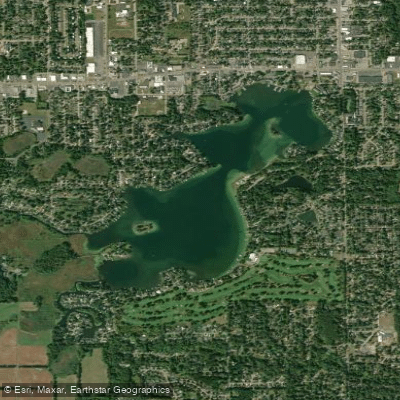
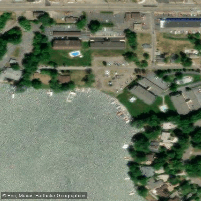
Goguac Lake is a 352-acre lake located in Battle Creek, Michigan, with a maximum depth of 66 feet. The lake offers two main access points: a DNR boat launch on the north side with 33 parking spaces and hard-surfaced ramp, and Willard Beach, a public park on the eastern shoreline. A recreation passport is required to use the DNR launch site.
The lake features three islands - Ward's Island, Peach Island, and what was historically known as Picnic Island - adding interest to paddling routes. Vegetation is generally sparse but includes patches of water lilies, native milfoil, pondweeds, and other aquatic plants. The shoreline is heavily developed, with 79% being seawall or riprap, though some natural wetland areas remain on the southwest side.
Summer brings significant powerboat traffic, as this is a popular all-sports lake. Powered watercraft must travel counterclockwise, and there is a 40 mph speed limit. Paddlers should be particularly mindful during peak boating hours between Memorial Day and Labor Day. The lake can become quite congested, especially on summer weekends.
Water clarity is good, with Secchi depth readings of 10 feet recorded. By late summer, surface temperatures reach the mid-70s Fahrenheit, with cooler layers below the thermocline at 21 feet. The lake has no natural outlets, and water levels fluctuate seasonally.
Wildlife viewing opportunities include various bird species, particularly around the remaining natural shorelines and wetland complex. Fish species include northern pike, largemouth bass, black crappie, and bluegill. The southwest wetlands provide important habitat for local wildlife.
Facilities at Willard Beach include parking and basic amenities, with admission fees of $2 per person or $5 for vehicles with three or more passengers. The beach closes at 8:30 PM. Swimming is not permitted at the DNR launch site, though fishing from the dock is allowed.
Water access, boat ramps & amenities
Learn how to get on Goguac Lake. Uncover great paddling access points, boat ramps, and all the facilities you need for an unforgettable day on the water. Some locations shown may border or include private property. Always check property boundaries and applicable regulations before visiting. PaddleWays's Public & Private Land layer can help you plan your access with confidence.
Paddle smarter with real-time insights
Whether you're en route and conditions shift or you're looking for the best spot based on current flows, we enable you to make informed decisions on the fly.








Find Places to Paddle

Over 400,000 Places to Paddle
Every user gets free access to launch points, boat ramps, and public property parcels.


Water and weather conditions (10 day forecast)
See the best times to paddle Goguac Lake and check the forecast before you go.
No forecast data available.
Paddling near Goguac Lake
Kalamazoo River
Grand River
Flat River
Saint Joseph River
Whitford Lake
Eagle Lake
Morrow Lake
Portage Lake
Gull Lake
Explore Michigan waters
Top paddling waters
Popular Cities
Loading popular cities...
Explore near Goguac Lake
Access points
Nearby waters
More in Michigan

Smarter Paddling Starts in the App.
Paddleways gives you everything you need to plan smarter, paddle better, and own every trip from first launch to takeout.