Burnet Bay
- Saltwater
- Bay
Burnet Bay
- Saltwater
- Bay
- Sq. miles
- 1.7
- Boat Ramps
- 0
- Access Points
- 1
- Campsites
- 0
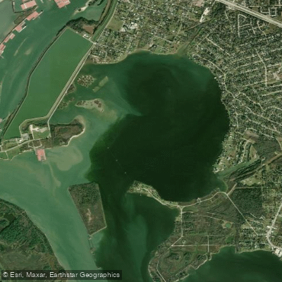
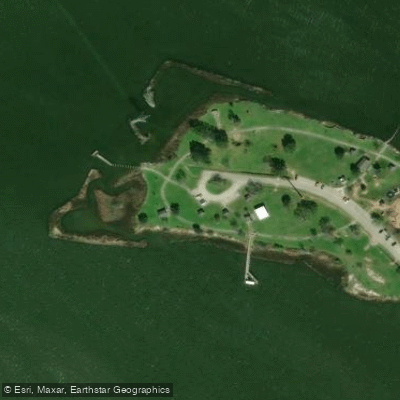
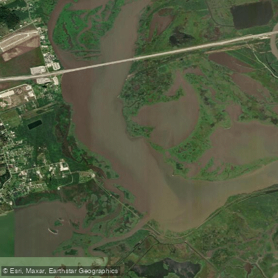
Burnet Bay is a saltwater bay on the Texas Gulf Coast, part of the complex of waterways near Baytown, east of Houston. It is characterized by calm, sheltered waters, making it suitable for kayaking and paddleboarding. The bay forms one side of the 500-acre Baytown Nature Center peninsula, which is also bordered by Crystal Bay and Scott Bay. A primary public access point is within the Baytown Nature Center, where a small, sandy west-facing beach serves as a launch area. The specific coordinates for this launch are 29° 45.366'N, 95° 2.963'W. Parking is available nearby. The Eddie V. Gray Wetlands Education Center also provides a kayak launch offering access to the broader bay system. The launch slope at the nature center can be mucky and slippery, and the shallow bays may have oysters and barnacles, requiring closed-toe footwear for protection. Some small boat traffic is present in the bays, but paddlers are mostly separated from the heavy commercial traffic of the nearby Houston Ship Channel. The area is exposed to typical Gulf Coast conditions, including sun, heat, humidity, and insects, necessitating ample water and sun protection. The surrounding landscape consists of tidal marshes, wetlands, and hardwood forests, providing habitat for over 300 species of birds, making it a significant birding destination on the Great Texas Coastal Birding Trail. Notable sights from the water include the San Jacinto Monument on the horizon and the Fred Hartman Bridge. The area has historical significance related to the Battle of San Jacinto, and the Lynchburg Ferry operates nearby. The Baytown Nature Center is open from sunrise to sunset, and an entry fee applies for visitors, which helps fund conservation efforts.
Water access, boat ramps & amenities
Learn how to get on Burnet Bay. Uncover great paddling access points, boat ramps, and all the facilities you need for an unforgettable day on the water. Some locations shown may border or include private property. Always check property boundaries and applicable regulations before visiting. PaddleWays's Public & Private Land layer can help you plan your access with confidence.
Paddle smarter with real-time insights
Whether you're en route and conditions shift or you're looking for the best spot based on current flows, we enable you to make informed decisions on the fly.








Find Places to Paddle

Over 400,000 Places to Paddle
Every user gets free access to launch points, boat ramps, and public property parcels.


Tides, wind & water conditions (10 day forecast)
On open water, wind and tide matter as much as the weather. See the best times to paddle Burnet Bay and check the marine forecast before you launch.
Loading tide predictions…
Paddling near Burnet Bay

Trinity River
West Fork San Jacinto River
Galveston Bay

Brazos River
Cypress Creek
Trinity Bay
Lake Houston
San Jacinto River
Old River Lake
Explore Texas waters
Top paddling waters
Popular Cities
Loading popular cities...
Explore near Burnet Bay

Smarter Paddling Starts in the App.
Paddleways gives you everything you need to plan smarter, paddle better, and own every trip from first launch to takeout.