Vinson Slough
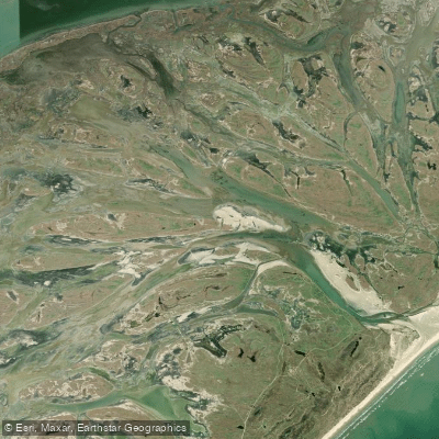
Vinson Slough
- Boat Ramps
- 0
- Access Points
- 0
- Campsites
- 0
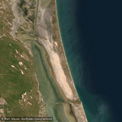
Vinson Slough is a dynamic coastal waterway in Texas that connects to Cedar Bayou and the Gulf of Mexico. The slough was dredged in 2014 to a width of 100 feet and depth of 6 feet, though its dimensions continue to change with tides and weather events. Paddlers should be prepared for varying water depths, from as shallow as 12-18 inches in some areas to over 8 feet deep in the main channels.
The area is rich in wildlife and natural beauty. Seagrass beds provide critical habitat for many marine species. Paddlers may encounter redfish, blue crab, Atlantic croaker, and southern flounder. The surrounding ecosystem supports diverse plant and animal life.
Water conditions can change rapidly in Vinson Slough. Strong currents are common, especially when flowing toward the Gulf. The slough's course shifts over time, with the opening to the Gulf continuing to move southward. Paddlers should exercise caution and check conditions before embarking.
Access points for Vinson Slough can be tricky to find. The nearest landmark is Mesquite Bay. It's crucial to research and identify suitable put-in locations before planning a trip.
The slough offers opportunities for fishing as well as wildlife viewing. Up to 25-30 boats have been observed in the area at peak times. While there are no specific paddling regulations, respect for private property and adherence to general boating laws is expected.
Paddlers should be prepared for a remote setting with few if any amenities. The dynamic nature of Vinson Slough means conditions can vary greatly from day to day or season to season. Checking current local information and tide charts is essential for a safe paddling experience in this ever-changing coastal environment.
Water access, boat ramps & amenities
Learn how to get on Vinson Slough. Uncover great paddling access points, boat ramps, and all the facilities you need for an unforgettable day on the water. Some locations shown may border or include private property. Always check property boundaries and applicable regulations before visiting. PaddleWays's Public & Private Land layer can help you plan your access with confidence.
Paddle smarter with real-time insights
Whether you're en route and conditions shift or you're looking for the best spot based on current flows, we enable you to make informed decisions on the fly.








Find Places to Paddle

Over 400,000 Places to Paddle
Every user gets free access to launch points, boat ramps, and public property parcels.


Water and weather conditions (10 day forecast)
See the best times to paddle Vinson Slough and check the forecast before you go.
No forecast data available.
Paddling near Vinson Slough
Explore Texas waters
Top paddling waters
Popular Cities
Loading popular cities...
Explore near Vinson Slough

Smarter Paddling Starts in the App.
Paddleways gives you everything you need to plan smarter, paddle better, and own every trip from first launch to takeout.