Bega River
- Saltwater
- Estuary
Bega River
- Saltwater
- Estuary
- Sq. miles
- 2.8
- Boat Ramps
- 0
- Access Points
- 0
- Campsites
- 0
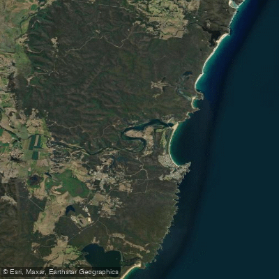
The Bega River is a tidal estuary system on the Sapphire Coast, offering a protected paddling environment through lagoons, bushland, and farmland. The river meets the sea at Mogareeka, north of Tathra. Two primary public access points serve paddlers. The Mogareeka Boat Ramp, located at Ray Whyman Reserve off the Tathra-Bermagui Road, provides a two-lane concrete ramp with a concrete pontoon, vehicle and trailer parking, public toilets, and a waste disposal bin. This is a key launch site for tours and independent paddlers heading into the estuary. Further upstream, the Blackfellows Lake Boat Ramp offers access via a single-lane concrete ramp with a fixed jetty and floating pontoon, parking for vehicles with trailers, and solar lighting, but no toilets. This ramp provides entry to both Blackfellows Lake and the connected Bega River.
The paddling experience is characterized by calm, sheltered waters suitable for all skill levels, with commercial tours noting easy entries and exits and no point being more than 500 meters from a safe landing site. The environment transitions from forested reeds in the lagoon areas to sand spits and riparian vegetation. Wildlife sightings commonly include egrets, azure kingfishers, and white-bellied sea eagles. The river has been the subject of ecological restoration and biodiversity surveys, indicating a revitalized natural habitat. Paddlers share the waterway with other recreational boaters and water-skiers, particularly near the Mogareeka access point. As a tidal system, paddlers must plan for tidal currents, especially near the river mouth where it meets the sea. The area is exposed to coastal winds, but the upper reaches and lagoons offer more protection. No specific regulations, seasonal restrictions, or water quality issues for paddlers are detailed in the provided information.
Water access, boat ramps & amenities
Learn how to get on Bega River. Uncover great paddling access points, boat ramps, and all the facilities you need for an unforgettable day on the water. Some locations shown may border or include private property. Always check property boundaries and applicable regulations before visiting. PaddleWays's Public & Private Land layer can help you plan your access with confidence.
Paddle smarter with real-time insights
Whether you're en route and conditions shift or you're looking for the best spot based on current flows, we enable you to make informed decisions on the fly.








Find Places to Paddle

Over 400,000 Places to Paddle
Every user gets free access to launch points, boat ramps, and public property parcels.


Tides, wind & water conditions (10 day forecast)
On open water, wind and tide matter as much as the weather. See the best times to paddle Bega River and check the marine forecast before you launch.
Loading tide predictions…
Paddling near Bega River

Murrumbidgee River

Molonglo River

Queanbeyan River

Cotter River

Googong Reservoir

Shoalhaven River

Lake Burrinjuck

Goobagandra River

Eucumbene River

Lake Eucumbene
Explore New South Wales waters
Top paddling waters
No waters available right now.
Popular Cities
Loading popular cities...
Explore near Bega River

Smarter Paddling Starts in the App.
Paddleways gives you everything you need to plan smarter, paddle better, and own every trip from first launch to takeout.