Brogo River
Brogo River
- Boat Ramps
- 0
- Access Points
- 0
- Campsites
- 0
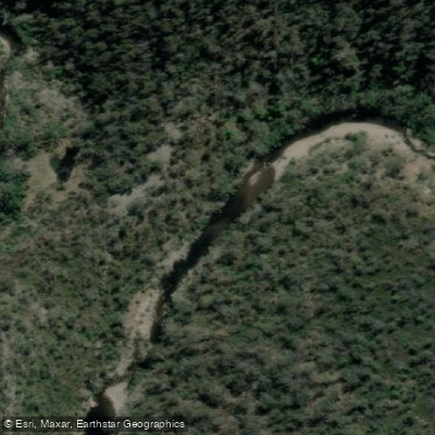
Brogo Dam, situated on the Brogo River approximately 30 kilometres north-west of Bega on the NSW South Coast, is the primary paddling destination on this waterway. The dam was built in 1976 to supply water to the dairy industry and sits within the southern section of Wadbilliga National Park, with the park's catchment covering around 400 square kilometres of the Brogo River's headwaters. The dam itself covers approximately 1 square kilometre and holds a capacity of 9 gigalitres. It is oriented in an east-west direction and fed by two main arms: Nelson Creek entering mid-way from the south, and the Brogo River entering at the western end.
The standard paddle covers 16.2 kilometres as an out-and-back trip from the boat ramp, with a typical duration of three to five hours. The grade is S01, meaning flat water with no portages required. There are no tides or currents to contend with. A concrete boat ramp is located on the southern side of the dam wall, with picnic tables and toilets nearby. Canoes are available for hire from a local operator. There are no shops or cafes in the area, so paddlers should bring all food and supplies. An 8 kph speed limit applies to power boats; water skiing is not permitted.
The Brogo River arm and Nelson Creek both offer opportunities to pull out for a break. In September and October, rock orchids can be seen on the steep cliffs along both arms. The rugged forested foreshores are largely inaccessible on foot, making the water the most practical means of exploring the area. Wildlife regularly spotted includes Sea Eagles, Wedge-tailed Eagles, hawks, Azure Kingfishers, Lyrebirds, Goannas, Water Dragons, deer, wallabies, and kangaroos. The dam is also stocked with Australian bass and trout.
Directions require care: travelling north on the Princes Highway from Bega, pass the Snowy Mountains Highway turnoff and continue 10 kilometres before turning left onto Warrigal Range Road. The dam is 14 kilometres along this unsealed road, with the final kilometre on Brogo Dam Road. GPS and Google Maps may direct paddlers to the northern side of the dam where there is no boat ramp access, so relying on printed maps or local tourism guides is advisable. The recreation area closes on all Total Fire Ban days.
Water access, boat ramps & amenities
Learn how to get on Brogo River. Uncover great paddling access points, boat ramps, and all the facilities you need for an unforgettable day on the water. Some locations shown may border or include private property. Always check property boundaries and applicable regulations before visiting. PaddleWays's Public & Private Land layer can help you plan your access with confidence.
Paddle smarter with real-time insights
Whether you're en route and conditions shift or you're looking for the best spot based on current flows, we enable you to make informed decisions on the fly.








Find Places to Paddle

Over 400,000 Places to Paddle
Every user gets free access to launch points, boat ramps, and public property parcels.


Water and weather conditions (10 day forecast)
See the best times to paddle Brogo River and check the forecast before you go.
Brogo River At North Brogo
All Flow Stations
Paddling near Brogo River

Murrumbidgee River

Molonglo River

Queanbeyan River

Cotter River

Googong Reservoir

Shoalhaven River

Lake Burrinjuck

Goobagandra River

Eucumbene River

Lake Eucumbene
Explore New South Wales waters
Top paddling waters
No waters available right now.
Popular Cities
Loading popular cities...
Explore near Brogo River

Smarter Paddling Starts in the App.
Paddleways gives you everything you need to plan smarter, paddle better, and own every trip from first launch to takeout.