Cullendulla Creek
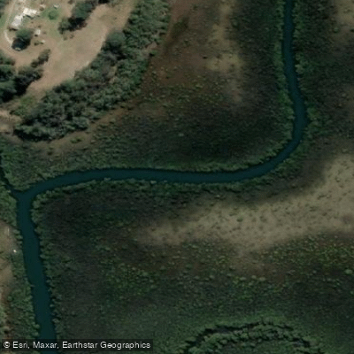
Cullendulla Creek
- Boat Ramps
- 0
- Access Points
- 0
- Campsites
- 0
Cullendulla Creek is a tidal estuary located just north of Batemans Bay on the New South Wales South Coast, flowing into Batemans Bay and protected within the Cullendulla Creek Nature Reserve. The creek has been designated a sanctuary zone within the Batemans Bay Marine Park, which carries specific regulations governing vessel use in the area. A South Cardinal mark limits vessel activity adjacent to Cullendulla Beach due to shallow water, and paddlers should be aware that the creek can become very shallow at low tide, making timing critical for a comfortable paddle.
The primary access point for paddling the creek is Korners Park on the northeast side of the Batemans Bay Bridge, from which paddlers travel approximately 2.8 kilometres along the north side of the bay before turning north into the creek. An alternative launch point is the protected beach at Surfside, accessible from the car park off Myamba Parade. A short path from Surfside leads north to Cullendulla Beach, which provides direct access to the creek mouth and serves as a useful contingency if bay conditions deteriorate. The paddle is best undertaken near the top of the tide to ensure adequate water depth throughout the creek.
Paddling up the creek, a raised boardwalk through the mangroves on the left bank marks the Cullendulla Nature Reserve, where interpretive signage covers the Aboriginal history of the area. Further upstream, remnants of a timber railway are visible on the left bank — the railway was historically used to transport timber from a mill to coastal shipping vessels. Paddlers can travel as far up the creek as water depth allows before retracing their route. The full return trip, including a paddle to Square Head and around Snapper Island, covers approximately 14 kilometres. Note that Snapper Island is a nature reserve and landings are not permitted there.
The creek and surrounding reserve support a notable variety of wildlife, including stingrays, octopus, crabs, fish, eagles, wading birds, oystercatchers, soldier crabs, and the southern emu wren. The mangrove environment and two rare chenier dune formations — the only examples of their kind south of North Queensland — add geological interest to the paddle. Facilities at the Surfside car park off Myamba Parade include parking and beach access, and a wheelchair-accessible boardwalk connects the car park to Cullendulla Beach.
Water access, boat ramps & amenities
Learn how to get on Cullendulla Creek. Uncover great paddling access points, boat ramps, and all the facilities you need for an unforgettable day on the water. Some locations shown may border or include private property. Always check property boundaries and applicable regulations before visiting. PaddleWays's Public & Private Land layer can help you plan your access with confidence.
Paddle smarter with real-time insights
Whether you're en route and conditions shift or you're looking for the best spot based on current flows, we enable you to make informed decisions on the fly.








Find Places to Paddle

Over 400,000 Places to Paddle
Every user gets free access to launch points, boat ramps, and public property parcels.


Water and weather conditions (10 day forecast)
See the best times to paddle Cullendulla Creek and check the forecast before you go.
No forecast data available.
Paddling near Cullendulla Creek

Murrumbidgee River

Molonglo River

Queanbeyan River

Cotter River

Googong Reservoir

Shoalhaven River

Lake Burrinjuck

Goobagandra River

Eucumbene River

Lake Eucumbene
Explore New South Wales waters
Top paddling waters
No waters available right now.
Popular Cities
Loading popular cities...
Explore near Cullendulla Creek

Smarter Paddling Starts in the App.
Paddleways gives you everything you need to plan smarter, paddle better, and own every trip from first launch to takeout.