Deua River
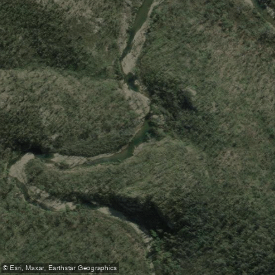
Deua River
- Boat Ramps
- 0
- Access Points
- 0
- Campsites
- 0
The Deua River is a 139-kilometre waterway in New South Wales, rising from the Badja Range on the Great Dividing Range within Deua National Park at an elevation of 641 metres, and flowing to its confluence with the Moruya River near Kiora at approximately 7 metres elevation. The river forms the freshwater upper reaches of the Moruya River system and passes through rugged, mountainous gorge country in the Eurobodalla region of the South Coast.
For whitewater paddlers, the upper sections within Deua National Park run at Grade One to easy Grade Two, with short easy rapids, flowing chutes, and stretches of moving or flat water between rapids. Unexpected Grade Three rapids have been encountered, and semi-epic portages around willow chokes and particularly rocky drops are possible. One documented trip ran approximately 13 kilometres from around one kilometre above Bakers Flat Campground to the Rural Fire Service station. During that paddle, the gauge at Riverview recorded an average of 1.35 metres or 1,230 ML/day on a falling level. Water levels significantly affect conditions, and flood-damaged road closures can complicate access planning.
A practical advantage of the upper river is that Araluen Road runs close to the water for much of its length, making exits relatively straightforward, though steep banks and prickly scrub can complicate egress in places. Bakers Flat Campground within Deua National Park serves as a convenient base and is accessible by 2WD vehicle. The campground offers toilets, unpowered and unmarked sites, barbecue facilities, picnic tables, and a car park, though paddlers must bring their own drinking water, cooking water, and firewood.
For flatwater paddlers, the lower reaches near Moruya offer a different experience. Launching from the Moruya town boat ramp on the east side of Moruya Bridge, paddlers can travel approximately 12 kilometres west to the Araluen Road bridge, with the river winding through farmland and forest. Above Araluen Road the river transitions into the Deua River proper; these upper reaches can become shallow and contain many obstructions, so checking maps and current conditions before venturing further is strongly recommended. A side trip up Womban Creek at high tide is noted as an interesting diversion.
Goannas and eastern water dragons are commonly seen sunning on rocks and branches overhanging the water.
Water access, boat ramps & amenities
Learn how to get on Deua River. Uncover great paddling access points, boat ramps, and all the facilities you need for an unforgettable day on the water. Some locations shown may border or include private property. Always check property boundaries and applicable regulations before visiting. PaddleWays's Public & Private Land layer can help you plan your access with confidence.
Paddle smarter with real-time insights
Whether you're en route and conditions shift or you're looking for the best spot based on current flows, we enable you to make informed decisions on the fly.








Find Places to Paddle

Over 400,000 Places to Paddle
Every user gets free access to launch points, boat ramps, and public property parcels.


Water and weather conditions (10 day forecast)
See the best times to paddle Deua River and check the forecast before you go.
No forecast data available.
Paddling near Deua River

Murrumbidgee River

Molonglo River

Queanbeyan River

Cotter River

Googong Reservoir

Shoalhaven River

Lake Burrinjuck

Goobagandra River

Eucumbene River

Lake Eucumbene
Explore New South Wales waters
Top paddling waters
No waters available right now.
Popular Cities
Loading popular cities...
Explore near Deua River

Smarter Paddling Starts in the App.
Paddleways gives you everything you need to plan smarter, paddle better, and own every trip from first launch to takeout.