Mongarlowe River
Mongarlowe River
- Boat Ramps
- 0
- Access Points
- 0
- Campsites
- 0
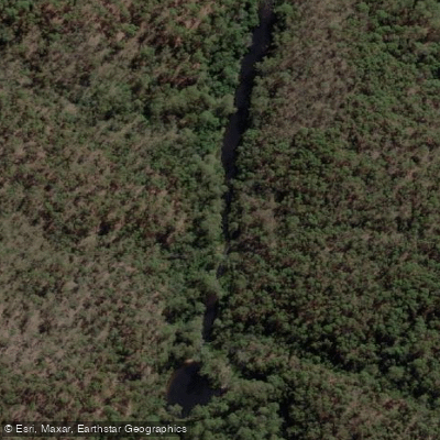
The Mongarlowe River flows through the Monga National Park region of New South Wales, in the Queanbeyan-Braidwood area. The river is gently flowing in its upper reaches near Monga, where it passes through wooded country over a partly sandy bed. The landscape alternates between hilly terrain and flat sections, with narrow, tree-lined races characterizing much of the river's character.
The Mongarlowe River is perhaps most relevant to paddlers as a tributary of the Shoalhaven River. One practical option is to put in at the Mongarlowe River Bridge and paddle approximately 3 kilometres downstream to the Shoalhaven junction, though this requires seeking permission from the property owner on the southern side of the Mongarlowe bridge. From that junction, paddlers continuing downstream on the Shoalhaven toward Oallen Ford will encounter Grade II and Grade IV rapids, with the Grade IV featuring two drops before a final one-metre chute running diagonal to the riverbank — this rapid warrants inspection before running, with portaging best accomplished on the right bank.
The river and surrounding national park are known for wildlife, including platypus, which can be spotted swimming in the water. The area is also notable for birdwatching, particularly in October and November when Monga and Gippsland waratahs flower and attract birds and insects. The Mongarlowe River picnic area at 715 River Forest Road, Monga NSW 2622, provides picnic tables and access to the Waratah walking track along the river.
For paddlers approaching the Mongarlowe as part of a longer Shoalhaven trip, the section from Charleyong to Oallen Ford covers 29 kilometres and is described as an easy two-day paddle or one long day, with campsites described as plentiful along the way. The car shuttle for that broader section is 42 kilometres one-way via Nerriga Road.
Water access, boat ramps & amenities
Learn how to get on Mongarlowe River. Uncover great paddling access points, boat ramps, and all the facilities you need for an unforgettable day on the water. Some locations shown may border or include private property. Always check property boundaries and applicable regulations before visiting. PaddleWays's Public & Private Land layer can help you plan your access with confidence.
Paddle smarter with real-time insights
Whether you're en route and conditions shift or you're looking for the best spot based on current flows, we enable you to make informed decisions on the fly.








Find Places to Paddle

Over 400,000 Places to Paddle
Every user gets free access to launch points, boat ramps, and public property parcels.


Water and weather conditions (10 day forecast)
See the best times to paddle Mongarlowe River and check the forecast before you go.
Mongarlowe River At Monga
All Flow Stations
Paddling near Mongarlowe River

Murrumbidgee River

Molonglo River

Queanbeyan River

Cotter River

Googong Reservoir

Shoalhaven River

Lake Burrinjuck

Goobagandra River

Eucumbene River

Lake Eucumbene
Explore New South Wales waters
Top paddling waters
No waters available right now.
Popular Cities
Loading popular cities...
Explore near Mongarlowe River

Smarter Paddling Starts in the App.
Paddleways gives you everything you need to plan smarter, paddle better, and own every trip from first launch to takeout.