Moruya River
- Saltwater
- Estuary
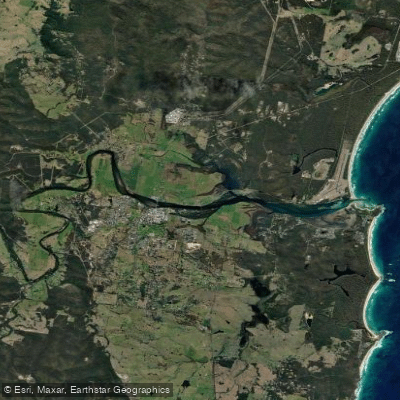
Moruya River
- Saltwater
- Estuary
- Sq. miles
- 3.4
- Boat Ramps
- 1
- Access Points
- 0
- Campsites
- 0
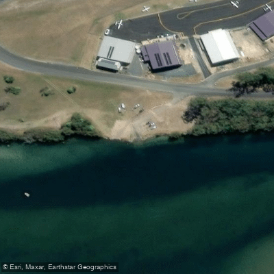
The Moruya River is a coastal estuary flowing through the town of Moruya on the New South Wales South Coast before meeting the Tasman Sea. For paddlers, the primary access point is the public boat ramp on the east side of the Moruya Bridge, managed by Eurobodalla Shire Council. Another key facility is Preddys Wharf, a public boat ramp and marine facility on the river. The estuary is popular for kayaking, boating, and swimming. A well-defined route, the Moruya Kayaking Trail - West, begins at the town boat ramp and extends 12 kilometres westward up to the bridge on Araluen Road. This scenic paddle winds through farmland and forest, leading toward the Deua River Valley. The river above the Araluen Road bridge can become shallow, and access to the upper reaches, where the river becomes the Deua River, is dependent on water level and may have obstructions. A notable side trip is a short exploration up Womban Creek, which is only possible at high tide. The overall character is tranquil, with gentle bank gradients providing easy launch spots. Paddlers should be mindful of other boat traffic given the presence of formal boat ramps and the waterway's popularity for motorized boating. Checking local conditions and maps is recommended, especially for journeys beyond the main trail.
Water access, boat ramps & amenities
Learn how to get on Moruya River. Uncover great paddling access points, boat ramps, and all the facilities you need for an unforgettable day on the water. Some locations shown may border or include private property. Always check property boundaries and applicable regulations before visiting. PaddleWays's Public & Private Land layer can help you plan your access with confidence.
Paddle smarter with real-time insights
Whether you're en route and conditions shift or you're looking for the best spot based on current flows, we enable you to make informed decisions on the fly.








Find Places to Paddle

Over 400,000 Places to Paddle
Every user gets free access to launch points, boat ramps, and public property parcels.


Tides, wind & water conditions (10 day forecast)
On open water, wind and tide matter as much as the weather. See the best times to paddle Moruya River and check the marine forecast before you launch.
Loading tide predictions…
Paddling near Moruya River

Murrumbidgee River

Molonglo River

Queanbeyan River

Cotter River

Googong Reservoir

Shoalhaven River

Lake Burrinjuck

Goobagandra River

Eucumbene River

Lake Eucumbene
Explore New South Wales waters
Top paddling waters
No waters available right now.
Popular Cities
Loading popular cities...
Explore near Moruya River
Access points
Nearby waters
More in New South Wales

Smarter Paddling Starts in the App.
Paddleways gives you everything you need to plan smarter, paddle better, and own every trip from first launch to takeout.