Gabo-Tullabergo
- Saltwater
- Beach
Gabo-Tullabergo
- Saltwater
- Beach
- Sq. miles
- 0.9
- Boat Ramps
- 0
- Access Points
- 0
- Campsites
- 0
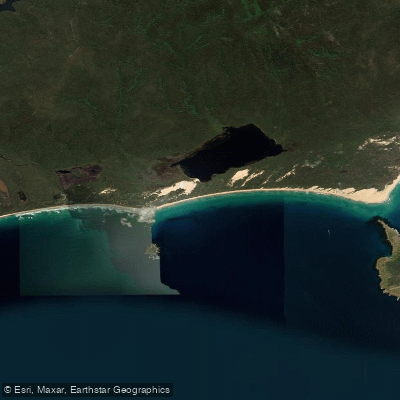
Gabo-Tullabergo is a 5.2-kilometer-long sandy beach located within Croajingolong National Park in the Shire of East Gippsland. It is a large, cuspate foreland protruding over a kilometer seaward, situated in the lee of Gabo Island to the east and Tullaberga Island to the west. The beach has a southern orientation, which exposes it directly to the dominant southerly swell, with average wave heights exceeding 1.5 meters. This exposure creates a wide, 350-meter surf zone characterized by two shore-parallel sandbars. The inner bar features alternating attached bars and deep rip currents spaced approximately every 300 meters, followed by a deep trough and an outer bar also cut by occasional rips. Access for paddlers launching from shore is extremely limited, as the beach can only be reached on foot via a 7-kilometer walk along the beach from Mallacoota Inlet or by boat. There is no dedicated parking, facilities, or amenities for paddlers at the beach itself. The strong westerly winds prevalent in the area blow sand into blowouts and sheets, which can contribute to challenging conditions. The beach is unpatrolled and carries a general hazard rating of 6 out of 10, with no surf lifesaving services provided. A notable historical feature is the wreck of the ship Riverina from 1923, located toward the eastern end of the beach. The surrounding area is part of the protected Croajingolong National Park.
Water access, boat ramps & amenities
Learn how to get on Gabo-Tullabergo. Uncover great paddling access points, boat ramps, and all the facilities you need for an unforgettable day on the water. Some locations shown may border or include private property. Always check property boundaries and applicable regulations before visiting. PaddleWays's Public & Private Land layer can help you plan your access with confidence.
Paddle smarter with real-time insights
Whether you're en route and conditions shift or you're looking for the best spot based on current flows, we enable you to make informed decisions on the fly.








Find Places to Paddle

Over 400,000 Places to Paddle
Every user gets free access to launch points, boat ramps, and public property parcels.


Tides, wind & water conditions (10 day forecast)
On open water, wind and tide matter as much as the weather. See the best times to paddle Gabo-Tullabergo and check the marine forecast before you launch.
Loading tide predictions…
Paddling near Gabo-Tullabergo

Murrumbidgee River

Molonglo River

Queanbeyan River

Cotter River

Googong Reservoir

Shoalhaven River

Lake Burrinjuck

Goobagandra River

Eucumbene River

Lake Eucumbene
Explore Victoria waters
Top paddling waters
No waters available right now.
Popular Cities
Loading popular cities...
Explore near Gabo-Tullabergo

Smarter Paddling Starts in the App.
Paddleways gives you everything you need to plan smarter, paddle better, and own every trip from first launch to takeout.