Lake Barracoota
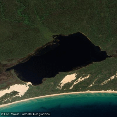
Lake Barracoota
- Boat Ramps
- 0
- Access Points
- 0
- Campsites
- 1
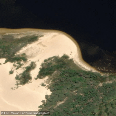
Lake Barracoota is a permanently filled freshwater lake located in the East Gippsland region of Victoria, situated entirely within Croajingolong National Park. When full, the lake covers a surface area of 240 hectares (590 acres). The eastern shoreline abuts a granite spur of the Howe Range, while the remaining shorelines are backed by dune sand or swamp deposits. Sand beaches occur at the eastern and western shores, with spits along the southern shore formed from coastal dune sand moved by wave action. Active parabolic dunes along the southern shore are actively spilling sand into the lake. Much of the shoreline is fringed by sedges and reeds including Baumea rubiginosa, Eleocharis sphacelata, and Phragmites australis at freshwater inflow points, with extensive thickets behind the vegetation.
Kayaking is feasible on the calm freshwater surface, and the lake is managed by Parks Victoria. Fishing is permitted with a valid Victorian Recreational Fishing Licence, subject to bag limits — five for estuary perch and two for Australian bass (minimum 27 cm length).
Access to the lake is challenging. No sealed roads reach the shores. The most common approach from Mallacoota, approximately 10–12 km to the west, involves taking a water taxi to Big Beach followed by a roughly 10 km hike through beach and dune systems to the lake's southwest corner. Vehicular access via rough 4WD tracks, including the Barracoota Link Track, requires high-clearance vehicles and local knowledge; these tracks are typically open from November to May, subject to closures. The campsite at the lake is walk-access only.
The recommended paddling and visiting season runs from September to May, with summer generally offering calmer weather. Paddlers should prepare for variable conditions including tides, weather, and the remoteness of the location. The surrounding national park environment supports wildlife viewing opportunities along approach trails. The lake's wilderness character, remote dune and coastal setting, and the absence of mainstream tourist infrastructure make it a destination suited to self-sufficient paddlers comfortable with extended approach routes and backcountry conditions.
Water access, boat ramps & amenities
Learn how to get on Lake Barracoota. Uncover great paddling access points, boat ramps, and all the facilities you need for an unforgettable day on the water. Some locations shown may border or include private property. Always check property boundaries and applicable regulations before visiting. PaddleWays's Public & Private Land layer can help you plan your access with confidence.
Paddle smarter with real-time insights
Whether you're en route and conditions shift or you're looking for the best spot based on current flows, we enable you to make informed decisions on the fly.








Find Places to Paddle

Over 400,000 Places to Paddle
Every user gets free access to launch points, boat ramps, and public property parcels.


Water and weather conditions (10 day forecast)
See the best times to paddle Lake Barracoota and check the forecast before you go.
No forecast data available.
Paddling near Lake Barracoota

Murrumbidgee River

Molonglo River

Queanbeyan River

Cotter River

Googong Reservoir

Shoalhaven River

Lake Burrinjuck

Goobagandra River

Eucumbene River

Lake Eucumbene
Explore Victoria waters
Top paddling waters
No waters available right now.
Popular Cities
Loading popular cities...
Explore near Lake Barracoota

Smarter Paddling Starts in the App.
Paddleways gives you everything you need to plan smarter, paddle better, and own every trip from first launch to takeout.