Bennett Lake
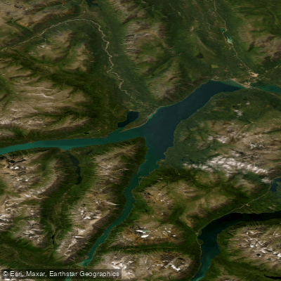
Bennett Lake
- Boat Ramps
- 0
- Access Points
- 0
- Campsites
- 1
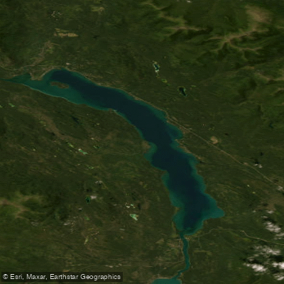
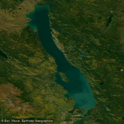
Bennett Lake straddles the border between British Columbia and Yukon Territory in northwestern Canada, with its southern portion in BC and its northern end at Carcross, Yukon. The lake sits at an elevation of approximately 642 metres (2,602 feet) and is part of the Southern Lakes chain that forms the upper reaches of the Yukon River system. Its total shoreline extends roughly 160 kilometres (100 miles), including the West Arm (about 16 kilometres long) and Millhaven Bay off the West Arm. Shores range from fine-sand beaches to rocky cliffs, with a large number of camping spots distributed along the lake.
The primary road access is at Carcross, Yukon, at the northern end of the lake. The southern end, at the ghost town of Bennett City, is accessible only by train, plane, boat, or by hiking the Chilkoot Trail. The narrow-gauge White Pass and Yukon Route Railway runs along the lake's eastern shore and offers seasonal excursions between Skagway, Alaska, and Carcross, with the option to transport canoes or kayaks for an additional fee. This makes a one-way paddle from Bennett City to Carcross a practical route, covering the full length of the lake.
Wind is the defining hazard on Bennett Lake and demands serious attention. The lake is notorious for sudden storms that can produce large waves, and paddlers have reported conditions severe enough to require abandoning canoes and walking out. Calm conditions are most reliably found in the early morning hours; afternoon winds tend to build significantly. With nearly 24 hours of daylight available in summer, paddling in the middle of the night during calm windows is a practical strategy. Ice-out timing varies by year and can extend into early June, so early-season paddlers should verify conditions before launching.
The lake carries considerable historical weight as the starting point of the water route used by tens of thousands of Klondike Gold Rush stampeders in 1897–1898. After crossing the Chilkoot Pass, prospectors built boats and rafts at Bennett City to continue north to Dawson City. The ghost town of Bennett remains on the southern shore and is a notable point of interest. Parks Canada manages campsites along the trail and at Bennett Lake, and reservations may be required depending on the season. Fishing on the lake includes lake trout and Arctic grayling, and a valid fishing licence is required for all fishing within Yukon Territory.
Water access, boat ramps & amenities
Learn how to get on Bennett Lake. Uncover great paddling access points, boat ramps, and all the facilities you need for an unforgettable day on the water. Some locations shown may border or include private property. Always check property boundaries and applicable regulations before visiting. PaddleWays's Public & Private Land layer can help you plan your access with confidence.
Paddle smarter with real-time insights
Whether you're en route and conditions shift or you're looking for the best spot based on current flows, we enable you to make informed decisions on the fly.







Yt licenses and regulations
No licenses or regulations available for Yt.
Find Places to Paddle

Over 400,000 Places to Paddle
Every user gets free access to launch points, boat ramps, and public property parcels.


Water and weather conditions (10 day forecast)
See the best times to paddle Bennett Lake and check the forecast before you go.
BENNETT LAKE AT CARCROSS
Explore Yt waters
Top paddling waters
No waters available right now.
Popular Cities
Loading popular cities...
Explore near Bennett Lake
Access points
Nearby waters
More in Yt

Smarter Paddling Starts in the App.
Paddleways gives you everything you need to plan smarter, paddle better, and own every trip from first launch to takeout.