River Wharfe
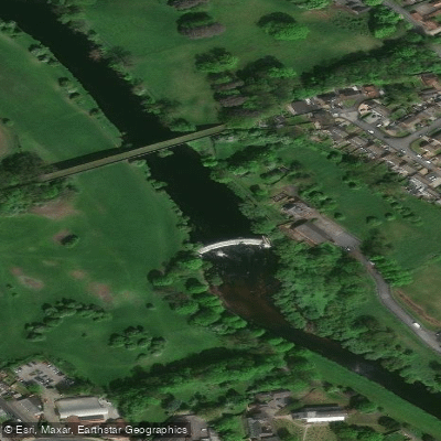
River Wharfe
- Boat Ramps
- 0
- Access Points
- 1
- Campsites
- 10
The River Wharfe is a Yorkshire river originating within the Yorkshire Dales National Park at Beckermonds in Langstrothdale, where Greenfield Beck and Oughtershaw Beck meet at an elevation of around 310 metres. From there it flows approximately 60 miles (97 km) southeast through Wharfedale before joining the River Ouse near Cawood, south of York. For much of its middle course it forms the county boundary between West Yorkshire and North Yorkshire.
The upper reaches of the river, from the source down to around Addingham, run through a steep, troughlike valley and have a distinctly different character from the lower sections. The river passes through or near Kettlewell, Grassington, Bolton Abbey, Addingham, Ilkley, Burley-in-Wharfedale, Otley, Wetherby, and Tadcaster. A popular paddling stretch runs from Bolton Abbey downstream through Ilkley to Otley, a section recommended for experienced paddlers. Those planning trips on this stretch are advised to identify the locations of weirs in advance and to check river levels before setting out, as both represent significant safety considerations.
The river corridor offers opportunities to observe water-loving wildlife including herons, otters, and kingfishers. Notable features along the route include Linton Falls near Grassington, which also hosts one of two hydro-electric generating plants on the river. The surrounding landscape of Wharfedale draws considerable tourism, and the valley is well served by waymarked walking routes, which can be useful for shuttle logistics.
Kayaking and canoeing are established activities on the Wharfe, and the river is used by paddlers of varying experience levels, though the upper sections in particular demand appropriate skill given the steeper gradient and more technical nature of the water. The lower reaches through the Vale of York are considerably more gentle in character. Paddlers should be aware of weirs throughout the river's course and treat them as primary hazards requiring careful scouting or portaging.
Water access, boat ramps & amenities
Learn how to get on River Wharfe. Uncover great paddling access points, boat ramps, and all the facilities you need for an unforgettable day on the water. Some locations shown may border or include private property. Always check property boundaries and applicable regulations before visiting. PaddleWays's Public & Private Land layer can help you plan your access with confidence.
Paddle smarter with real-time insights
Whether you're en route and conditions shift or you're looking for the best spot based on current flows, we enable you to make informed decisions on the fly.








Find Places to Paddle

Over 400,000 Places to Paddle
Every user gets free access to launch points, boat ramps, and public property parcels.


Water and weather conditions (10 day forecast)
See the best times to paddle River Wharfe and check the forecast before you go.
Kettlewell
All Flow Stations
Paddling near River Wharfe
River Aire

HUMBER UPPER
River Colne

River Dearne
RIBBLE
River Nidd
River Don

HUMBER MIDDLE
Aire and Calder Navigation
Explore England waters
Top paddling waters
No waters available right now.
Popular Cities
Loading popular cities...
Explore near River Wharfe
Access points
Nearby waters
More in England

Smarter Paddling Starts in the App.
Paddleways gives you everything you need to plan smarter, paddle better, and own every trip from first launch to takeout.