Curated by PaddleWays
RouteFlatwater
- Distance
- 1.9 mi
- Paddle time
- ~0.5 hrs
- Put-in → take-out
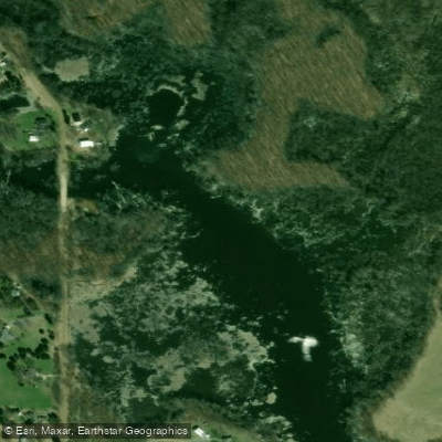
- Laingsburg Road Access → Hollister Road Access
The Looking Glass River flows westward through central Michigan's Clinton County region, serving as a tributary to the Grand River. This waterway carves through a landscape that transitions from rural farmland to wooded corridors, maintaining a generally placid character that makes it accessible to paddlers of varying skill levels.
The river's current flows generally west, passing through communities including Laingsburg, Bath Township, and DeWitt before eventually joining the Grand River system. The waterway is part of the Middle Grand River watershed, which encompasses the Looking Glass, Red Cedar, and Maple river systems. The Michigan Department of Natural Resources manages several access points along the river, with Babcock's Landing serving as a primary put-in location for many paddlers exploring this waterway.
Paddling opportunities span from short two-hour excursions to full-day adventures covering up to 12 miles. The Lowell Road to Bauer Road section offers approximately 9 river miles through predominantly wooded terrain with minimal residential development. Paddlers frequently encounter ducks, great blue herons, red-tailed hawks, Cooper's hawks, and pileated woodpeckers along this stretch. The longer Babcock's Landing to Looking Glass Riverfront Park route extends roughly 12 miles through DeWitt Township, requiring portages around fallen trees—a recurring characteristic of this river system.
Water levels dramatically affect the paddling experience. During high water, the river runs swift with fast current and may overflow its banks, creating exciting conditions for experienced paddlers. At lower levels, particularly later in the season, careful navigation is necessary to avoid scraping, with some sections requiring strategic steering through shallow areas. The river bottom varies from sandy stretches to areas with river mud, particularly near portage sites.
The Looking Glass River holds significant historical value, flowing through areas once used as seasonal hunting and fishing camps by Native Americans, including territories associated with Chief Okemos. Five known Native American villages bordered the river, including one called Indian Green located just a mile from modern DeWitt. The Babcock family settled their property along the river in 1848, establishing farms and carpentry operations that shaped the region's early development.
Anglers find bass, northern pike, and carp in these waters, with shore fishing and boat access available at multiple points. Looking Glass Riverfront Park in DeWitt provides developed access at 3912 Herbison Road, while Babcock's Landing on Babcock Road near the intersection of Chandler and Round Lake Roads offers parking and carry-in boat launch facilities. Additional access exists at Heritage Park and Looking Glass Valley Park downstream.
Paddlers should prepare for multiple portages due to fallen trees and attach 15-foot ropes to their craft for easier maneuvering around obstacles. Personal flotation devices are required, and protective water shoes are recommended for portaging through muddy sections.
Curated routes
Hand-picked by the PaddleWays team, with put-ins, take-outs, paddle times and the hazards along the way.
RouteFlatwater
Hazards
No hazards are marked on Looking Glass River yet. That is not the same as none being there: if you find one, report it for the next paddler.
From the community
Real trips from PaddleWays paddlers: which route they ran, how the flows were, and what to watch for.
Loading trip reports
Kendra R.
128 cfs at Eagle
River
Kendra R.
Looking glass river• 113 cfs at Eagle
From Laingsburg rd to Hollisterrd
See exactly where the public can get on and off the river. Launch points and boat ramps are paired with PaddleWays' public land data so you know where you can legally land.
Public shoreline
2%of the river's shoreline is public
Most of the riverbank is private. Launch, land and camp only at public access points.
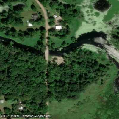
Boat Ramp
Boat Ramp
Flows, weather and a route-by-route verdict, so you know which stretch of the Looking Glass River is worth paddling today.
Live flows, marked hazards and fresh trip reports from paddlers who were just on the water, all in one place.





Every user gets free access to launch points, boat ramps, and public property parcels.

Loading popular cities...
PaddleWays gives you everything you need to plan smarter, paddle better, and own every trip from first launch to takeout.





