Curated by PaddleWays
RouteFlatwater
- Distance
- 4.2 mi
- Paddle time
- ~1.5 hrs
- Put-in → take-out
- Dabbs Greer Town Access → Lanagan Boat Ramp
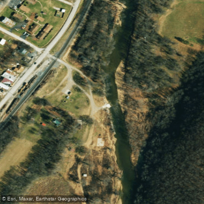
Concrete slab with drop-off at Bosky Dell Ford
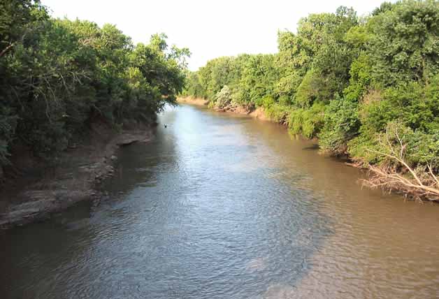
Indian Creek originates in the Ozark highlands near Fairview in Newton County, Missouri, flowing southwest through both Newton and McDonald counties before joining the Elk River near Anderson. This spring-fed tributary cuts through the Springfield Plateau, creating a clear-water stream characterized by chert gravel and cobble substrates. The creek maintains a notably consistent gradient of approximately 10 feet per mile through most of its 26-mile course, though steeper sections exist in the upper reaches where gradients can exceed the average significantly. The creek flows through a landscape of rolling hills with localized relief reaching 400 feet, carving through limestone and dolomite bedrock that creates the karst topography typical of this region. This geology produces numerous springs that feed the creek, helping maintain flow even during drier periods, though sections of the upper creek are known to lose water into the streambed during low-flow conditions.
Paddling opportunities on Indian Creek center on the section from Upper Indian Creek to the McNatt mill dam area, classified as Class II water. The Dabbs Greer Town Hole Park in Anderson serves as a primary access point for this reach. This section offers a fast, steady run through relatively undisturbed countryside, making it popular among intermediate paddlers seeking consistent gradient without extreme technical challenges. The creek's reputation rests on providing one of the better general gradients in the Ozarks—not flashy with dramatic falls or spectacular runs, but reliable and engaging throughout.
Spring and early summer provide optimal paddling conditions when water levels support continuous floating. During lower water periods, particularly late summer and fall, paddlers may encounter shallow sections requiring portaging or wading. The creek's narrow channel and tree-lined banks create a more intimate paddling experience compared to larger regional rivers, though this also means increased vigilance for strainers and log jams, particularly around the creek's numerous bends.
The fishery supports smallmouth bass, rock bass, and various sunfish species, with the clear water allowing excellent visibility for spotting fish. Wildlife sightings commonly include great blue herons, turtles, and white-tailed deer along the wooded corridors.
A mandatory portage exists before the McNatt mill dam, requiring paddlers to scout and carry around this obstacle. The creek's proximity to Anderson makes it accessible for day trips, though its relatively undeveloped character means facilities remain limited beyond the town park access point. The combination of steady gradient, clear water, and manageable technical difficulty has established Indian Creek as a worthwhile destination for paddlers seeking a faster-paced Ozark stream experience without venturing into advanced whitewater territory.
Curated routes
Hand-picked by the PaddleWays team, with put-ins, take-outs, paddle times and the hazards along the way.
RouteFlatwater
Hazards
No hazards are marked on Indian Creek yet. That is not the same as none being there: if you find one, report it for the next paddler.
From the community
Real trips from PaddleWays paddlers: which route they ran, how the flows were, and what to watch for.
Loading trip reports
Mark Z.
2.46 ft at Lanagan
21 people 15 boats. Maddux got caught in 2 places and needed saved
See exactly where the public can get on and off the river. Launch points and boat ramps are paired with PaddleWays' public land data so you know where you can legally land.
Public shoreline
0%of the river's shoreline is public
Most of the riverbank is private. Launch, land and camp only at public access points.
Flows, weather and a route-by-route verdict, so you know which stretch of the Indian Creek is worth paddling today.
Live flows, marked hazards and fresh trip reports from paddlers who were just on the water, all in one place.





Every user gets free access to launch points, boat ramps, and public property parcels.
Loading popular cities...
PaddleWays gives you everything you need to plan smarter, paddle better, and own every trip from first launch to takeout.