Lake Koshkonong
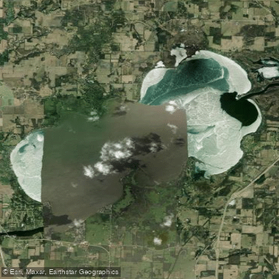
Lake Koshkonong
- Boat Ramps
- 4
- Access Points
- 4
- Campsites
- 1
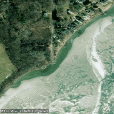
Lake Koshkonong is a 10,595-acre lake in southern Wisconsin with a maximum depth of 7 feet. This shallow lake is ideal for paddling, particularly canoeing and kayaking. Multiple public boat landings and beaches provide access points. The lake's size was increased by the creation of the Indianford Dam in 1932, making it one of the larger lakes in the state.
Paddlers can expect a diverse ecosystem, with the lake and surrounding wetlands home to American White Pelicans and Sandhill Cranes. The lake supports around 60 fish species, including musky, largemouth and smallmouth bass, northern pike, walleye, catfish, and panfish, making it a popular fishing destination.
Water clarity is very low, which may impact the aesthetic experience. The lake's shallow depth can make it susceptible to wind-driven waves, so paddlers should be cautious of changing weather conditions. Due to its size, Lake Koshkonong can be dangerous for small boats in windy conditions.
Several amenities cater to paddlers and visitors. The Anchor (718 WI-59, Edgerton) and Rock River Marina (520 E. Richardson Springs Rd., Edgerton) offer boat-related services. For those looking to stay overnight, options include Lakeland RV Campground and Pettit's Lakeview Campground and Bar.
Lake Koshkonong transforms into a winter recreation area, popular for ice fishing and snowmobiling when frozen. However, paddlers should be aware that the lake can become quite busy with various watercraft during peak summer months.
For a unique paddling experience, consider exploring the flooded woods where Koshkonong Creek enters the lake, offering a way-finding adventure through tree-lined waterways before reaching open water.
Water access, boat ramps & amenities
Learn how to get on Lake Koshkonong. Uncover great paddling access points, boat ramps, and all the facilities you need for an unforgettable day on the water. Some locations shown may border or include private property. Always check property boundaries and applicable regulations before visiting. PaddleWays's Public & Private Land layer can help you plan your access with confidence.
Paddle smarter with real-time insights
Whether you're en route and conditions shift or you're looking for the best spot based on current flows, we enable you to make informed decisions on the fly.








Find Places to Paddle

Over 400,000 Places to Paddle
Every user gets free access to launch points, boat ramps, and public property parcels.


Water and weather conditions (10 day forecast)
See the best times to paddle Lake Koshkonong and check the forecast before you go.
LAKE KOSHKONONG NEAR NEWVILLE, WI
Paddling near Lake Koshkonong

Rock River
Rock Lake

Lake Monona
Yahara River
Lake Mendota
Bark River
Kishwaukee River
Fox River
Oconomowoc River
Explore Wisconsin waters
Top paddling waters
Popular Cities
Loading popular cities...
Explore near Lake Koshkonong
Access points
Nearby waters
More in Wisconsin

Smarter Paddling Starts in the App.
Paddleways gives you everything you need to plan smarter, paddle better, and own every trip from first launch to takeout.