Atlin Lake
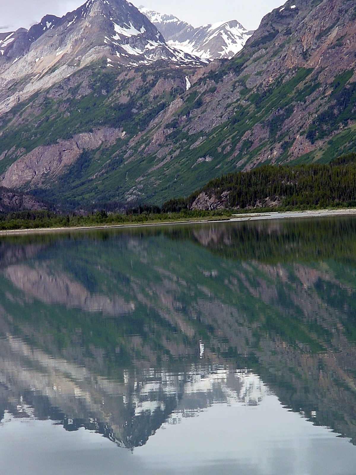
Atlin Lake
- Boat Ramps
- 1
- Access Points
- 3
- Campsites
- 3
Atlin Lake sits in the remote northwest corner of British Columbia on the traditional territory of the Taku River Tlingit First Nation. It is the largest natural lake in the province, running roughly 137 kilometres long in a narrow north-south orientation, with a maximum depth of approximately 283 metres and an elevation of around 668 metres. The northern tip connects with Little Atlin Lake near the BC-Yukon border. The lake is glacially fed and surrounded by mountains and icefields, with views of the Llewellyn Glacier, the second-largest glacier in the Juneau Icefield.
The primary Warm Bay access point for paddling the southern portion of the lake, which falls within Áa Tlein Téix̱'i Provincial Park (Atlin Provincial Park), is Warm Bay. The town of Atlin, on the east shore, also offers a marina, floatplane docks, and a boat launch. The park itself is not accessible by vehicle; entry must be by boat or aircraft. Atlin is reached via Highway 7, approximately 60 miles south of Jake's Corner on the Alaska Highway.
Safety is a serious concern on this lake. The water averages around 4°C, meaning hypothermia can set in within minutes of immersion. The lake is subject to sudden, strong winds that can generate steep, rough waves despite a deceptively calm surface. Winds of 50–70 km/h have been recorded. Paddlers should wear lifejackets at all times, and canoeists are advised to use a spray skirt. A dry suit or dry top is strongly recommended. Topographic maps are highly recommended given the scale of the landscape. Only paddlers with solid kayaking or canoeing experience should attempt the open lake.
Mornings tend to offer calmer conditions, while afternoon winds are a consistent pattern. Summer brings up to 19 hours of daylight, making it well suited to multi-day expeditions. The scattered islets and winding shoreline provide options for protected campsites and boat-access hiking trails. Wildlife in the area includes grizzly bears, moose, and caribou. The lake supports lake trout, Arctic grayling, Dolly Varden, and two species of whitefish; a valid British Columbia fishing licence is required.
One documented route involves putting in at Warm Bay, paddling approximately 70 kilometres south toward the Llewellyn Glacier, then returning north toward the Atlin River to connect with the broader Yukon River watershed via Tagish and Marsh Lakes.
Water access, boat ramps & amenities
Learn how to get on Atlin Lake. Uncover great paddling access points, boat ramps, and all the facilities you need for an unforgettable day on the water. Some locations shown may border or include private property. Always check property boundaries and applicable regulations before visiting. PaddleWays's Public & Private Land layer can help you plan your access with confidence.
Paddle smarter with real-time insights
Whether you're en route and conditions shift or you're looking for the best spot based on current flows, we enable you to make informed decisions on the fly.







Bc licenses and regulations
No licenses or regulations available for Bc.
Find Places to Paddle

Over 400,000 Places to Paddle
Every user gets free access to launch points, boat ramps, and public property parcels.


Water and weather conditions (10 day forecast)
See the best times to paddle Atlin Lake and check the forecast before you go.
ATLIN LAKE AT ATLIN
All Flow Stations
Paddling near Atlin Lake
Explore Bc waters
Top paddling waters
No waters available right now.
Popular Cities
Loading popular cities...
Explore near Atlin Lake
Access points
Nearby waters
More in Bc

Smarter Paddling Starts in the App.
Paddleways gives you everything you need to plan smarter, paddle better, and own every trip from first launch to takeout.