Chiganois River
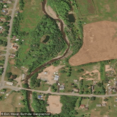
Chiganois River
- Boat Ramps
- 0
- Access Points
- 0
- Campsites
- 0
The Chiganois River is located in the Belmont/Masstown area of Nova Scotia, accessible from Highway 104 via the Debert exit (exit 13). The run is characterized predominantly by class III-IV rapids, with the most demanding section reaching class V. Paddlers should come prepared with all appropriate safety equipment, as the river passes through a gorge where access to roads is limited, making it effectively a more remote day trip despite its proximity to major highways.
The put-in is reached by continuing past the take-out on Belmont Road, staying right onto Upper Belmont Road, which transitions to a dirt road. Staying right at the fork leads to the put-in on a small feeder creek that can appear little more than a ditch. The take-out is on Graham Road off Belmont/Masstown Road, where the river is visible down a hill to the right. A vehicle shuttle between the two points is required.
One notable hazard near the take-out warrants particular attention: barbed wire has been strung across the river in the past, adjacent to a cow field. This wire can be difficult to spot and demands heightened alertness as paddlers approach the final section. Below the main whitewater, there are a few kilometers of class I paddling leading to the take-out.
The Chiganois River also supports striped bass fishing, which may mean encountering anglers along certain stretches, particularly in the lower, calmer sections of the river.
Water access, boat ramps & amenities
Learn how to get on Chiganois River. Uncover great paddling access points, boat ramps, and all the facilities you need for an unforgettable day on the water. Some locations shown may border or include private property. Always check property boundaries and applicable regulations before visiting. PaddleWays's Public & Private Land layer can help you plan your access with confidence.
Paddle smarter with real-time insights
Whether you're en route and conditions shift or you're looking for the best spot based on current flows, we enable you to make informed decisions on the fly.








Find Places to Paddle

Over 400,000 Places to Paddle
Every user gets free access to launch points, boat ramps, and public property parcels.


Water and weather conditions (10 day forecast)
See the best times to paddle Chiganois River and check the forecast before you go.
No forecast data available.
Paddling near Chiganois River
Explore Ns waters
Top paddling waters
No waters available right now.
Popular Cities
Loading popular cities...
Explore near Chiganois River

Smarter Paddling Starts in the App.
Paddleways gives you everything you need to plan smarter, paddle better, and own every trip from first launch to takeout.