Cobequid Bay
- Saltwater
- Bay
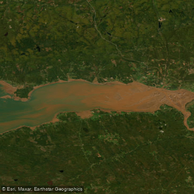
Cobequid Bay
- Saltwater
- Bay
- Sq. miles
- 117
- Boat Ramps
- 0
- Access Points
- 0
- Campsites
- 0
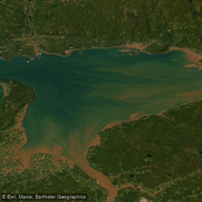
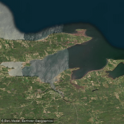
Cobequid Bay is a broad, shallow arm of the Bay of Fundy's Minas Basin in Nova Scotia, known for the world's highest tides. The bay is characterized by vast expanses of exposed red sand and mudflats at low tide, which transform into a substantial body of water at high tide. The primary paddling interest centers on the interaction of these extreme tides with the Shubenacadie River, which flows into the bay's eastern end. The area's most notable phenomenon is the tidal bore, a standing wave that forms as the incoming tide surges into the narrowing river channel. This bore can vary from a small ripple to a wave several feet high and creates dynamic, temporary wave sets and rapids upstream, particularly noted near a bluff called Anthony's Nose. Paddling here is a highly technical and potentially hazardous endeavor suited only for experienced kayakers familiar with powerful tidal currents and rapidly changing conditions. The tidal rhythm dictates all activity; paddlers must plan launches and take-outs meticulously around tide tables to avoid being stranded by the massive tidal range or caught in strong currents. Key access points for observing or engaging with this environment include the wharf and dyke area in Maitland, which offers a view of the bore entering the river mouth, and the Shubie River Park on Highway 2, noted as a launch point for experienced kayakers. The surrounding area, part of the Cliffs of Fundy Geopark, features historical sites like the preserved Lawrence House and offers expansive views of the dramatic tidal landscape. The water is typically a coffee-colored, silty mix of saltwater and river outflow. Due to the powerful and unpredictable nature of the tides, this area presents significant hazards, including the risk of being swept by strong currents, stranded on rapidly flooding mudflats, or encountering large waves during the bore. Paddlers must possess advanced skills and consult detailed, location-specific tide charts before any trip.
Water access, boat ramps & amenities
Learn how to get on Cobequid Bay. Uncover great paddling access points, boat ramps, and all the facilities you need for an unforgettable day on the water. Some locations shown may border or include private property. Always check property boundaries and applicable regulations before visiting. PaddleWays's Public & Private Land layer can help you plan your access with confidence.
Paddle smarter with real-time insights
Whether you're en route and conditions shift or you're looking for the best spot based on current flows, we enable you to make informed decisions on the fly.








Find Places to Paddle

Over 400,000 Places to Paddle
Every user gets free access to launch points, boat ramps, and public property parcels.


Tides, wind & water conditions (10 day forecast)
On open water, wind and tide matter as much as the weather. See the best times to paddle Cobequid Bay and check the marine forecast before you launch.
Loading tide predictions…
Paddling near Cobequid Bay
Explore Ns waters
Top paddling waters
No waters available right now.
Popular Cities
Loading popular cities...
Explore near Cobequid Bay

Smarter Paddling Starts in the App.
Paddleways gives you everything you need to plan smarter, paddle better, and own every trip from first launch to takeout.