Nałasìn River
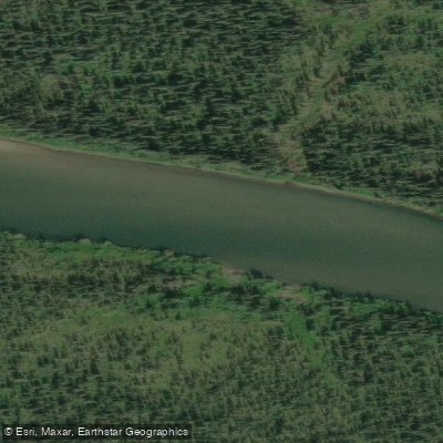
Nałasìn River
- Boat Ramps
- 0
- Access Points
- 0
- Campsites
- 1
The Nałasìn River (also known as the Nisutlin River) is located in the southwest corner of Yukon, Canada. The name Nisutlin derives from a Tlingit word meaning "quiet waters." The river originates in the Yukon's Pelly Mountains and flows south, eventually emptying into Teslin Lake.
A common put-in point is accessed via the South Canol Road, a historic route built during World War II to transport oil from the Northwest Territories. The South Canol Road runs approximately 230 km from Johnsons Crossing to Ross River, and the river campground used as a launch point is located at roughly km 67.5 (mile 42) along this road. The road is described as rough and winding through mountainous terrain. Shuttle logistics can be arranged through local outfitters such as Nisutlin Outfitters, whose operator has been known to drive paddlers' vehicles to Teslin Lake while paddlers complete the trip by water. The journey concludes on Teslin Lake, which adds approximately 11 km of lake paddling to reach the takeout. Paddlers should be aware that Teslin Lake can produce significant wind, potentially causing weather delays at the end of the trip.
The river corridor is characterized by extensive wetlands and spruce forests, providing habitat for moose, wolf, bear, beaver, and a variety of migratory birds and waterfowl. Animal tracks along sandy riverbanks are commonly encountered. The overall character of the paddle is relatively gentle, consistent with the Tlingit meaning of the name, making it accessible to paddlers with limited river experience while still offering a multi-day wilderness experience.
Water levels can vary considerably and have been noted to reach record highs in some seasons, which can affect safety and access. Wildfire activity in the broader region is also a factor that has historically influenced trip planning decisions. Paddlers should monitor conditions and consult local outfitters before departure.
Water access, boat ramps & amenities
Learn how to get on Nałasìn River. Uncover great paddling access points, boat ramps, and all the facilities you need for an unforgettable day on the water. Some locations shown may border or include private property. Always check property boundaries and applicable regulations before visiting. PaddleWays's Public & Private Land layer can help you plan your access with confidence.
Paddle smarter with real-time insights
Whether you're en route and conditions shift or you're looking for the best spot based on current flows, we enable you to make informed decisions on the fly.







Yt licenses and regulations
No licenses or regulations available for Yt.
Find Places to Paddle

Over 400,000 Places to Paddle
Every user gets free access to launch points, boat ramps, and public property parcels.


Water and weather conditions (10 day forecast)
See the best times to paddle Nałasìn River and check the forecast before you go.
No forecast data available.
Paddling near Nałasìn River
Explore Yt waters
Top paddling waters
No waters available right now.
Popular Cities
Loading popular cities...
Explore near Nałasìn River
Access points
Nearby waters
More in Yt

Smarter Paddling Starts in the App.
Paddleways gives you everything you need to plan smarter, paddle better, and own every trip from first launch to takeout.