Arroyo Burro Beach
- Saltwater
- Beach
Arroyo Burro Beach
- Saltwater
- Beach
- Sq. miles
- 0
- Boat Ramps
- 0
- Access Points
- 1
- Campsites
- 0
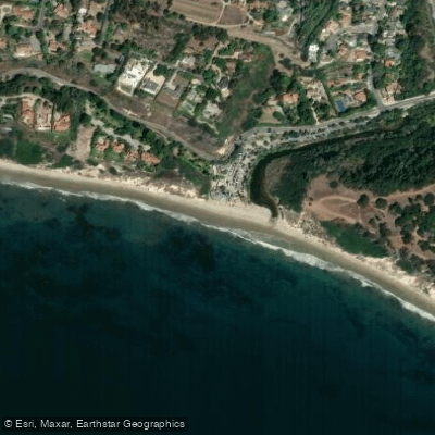
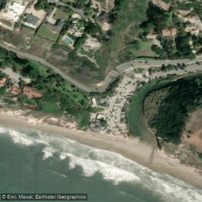
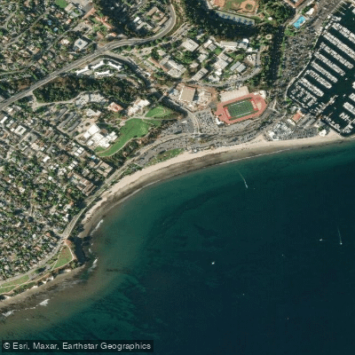
Arroyo Burro Beach, also known locally as Hendry's Beach, is a scenic coastal bay located just west of downtown Santa Barbara. The beach is backed by high bluffs, creating a secluded and dramatic setting. The primary access point is via a parking lot at the park entrance off Cliff Drive. From the south end of the parking lot, a path leads down to the sand, requiring a carry of about 150 feet to the tideline. The beach itself is broad, with a winding coastline. The water conditions are generally characterized by light surf and gentle bays, making it suitable for paddlers of various skill levels. However, the beach faces the open channel, and western swells can hit the area, creating choppy conditions; paddlers should watch the swells and be aware that conditions can change. The beach break can offer waves suitable for surfing, paddleboarding, and kayaking, but the main break, known as 'the pit,' can be more challenging and is not recommended for beginners. After rainstorms, water quality near the seasonal Arroyo Burro Creek outflow can be a concern. The beach is dog-friendly, but dogs must be leashed on the sand. Amenities for paddlers include a parking lot, public restrooms, and the Boathouse Restaurant. The surrounding area features the Douglas Family Preserve, a 70-acre undeveloped park with trails offering ocean views, and it is a noted spot for watching dolphins and whales. A popular day trip for intermediate paddlers on calm days is a roughly 4.5-mile round trip paddle east to Butterfly Beach in Montecito. The beach has a vibrant, community-oriented atmosphere and is a popular destination for locals and visitors alike.
Water access, boat ramps & amenities
Learn how to get on Arroyo Burro Beach. Uncover great paddling access points, boat ramps, and all the facilities you need for an unforgettable day on the water. Some locations shown may border or include private property. Always check property boundaries and applicable regulations before visiting. PaddleWays's Public & Private Land layer can help you plan your access with confidence.
Paddle smarter with real-time insights
Whether you're en route and conditions shift or you're looking for the best spot based on current flows, we enable you to make informed decisions on the fly.








Find Places to Paddle

Over 400,000 Places to Paddle
Every user gets free access to launch points, boat ramps, and public property parcels.


Tides, wind & water conditions (10 day forecast)
On open water, wind and tide matter as much as the weather. See the best times to paddle Arroyo Burro Beach and check the marine forecast before you launch.
Loading tide predictions…

Explore California waters
Top paddling waters
Popular Cities
Loading popular cities...
Explore near Arroyo Burro Beach
Access points
Nearby waters
More in California

Smarter Paddling Starts in the App.
Paddleways gives you everything you need to plan smarter, paddle better, and own every trip from first launch to takeout.