Buena Vista Lagoon
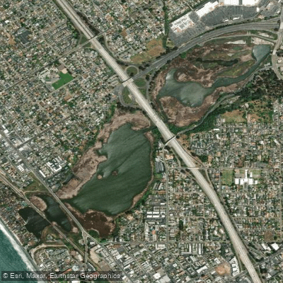
Buena Vista Lagoon
- Boat Ramps
- 0
- Access Points
- 1
- Campsites
- 1
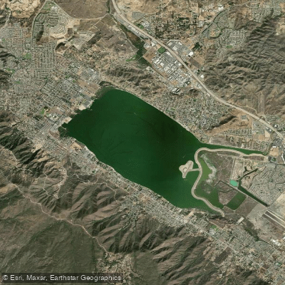
Buena Vista Lagoon is a 350-acre freshwater lagoon located between Carlsbad and Oceanside, California. As California's first ecological reserve (designated in 1969), the lagoon does not permit kayaking or other watercraft, as these activities would disturb the natural habitats. The lagoon is owned and managed by the California Department of Fish and Wildlife as an ecological preserve.
While paddling is not allowed, the lagoon offers excellent wildlife viewing opportunities from several designated observation points. More than 235 bird species have been documented here, including California Quail, Vermillion Flycatcher, and Great Blue Heron. The lagoon serves as a critical stop along the Pacific Flyway migration route, with peak bird activity during winter and summer migrations.
Visitors can observe the lagoon from three main viewing areas: - Maxton Brown Park (Laguna Avenue and State Street) - Ecological Wildlife Viewing Area (Jefferson Street and Marron Road) - Buena Vista Audubon Society Nature Center (Coast Highway in Oceanside)
The Nature Center, open Tuesday through Saturday from 10 am to 1 pm, offers interpretive displays, guided bird watching tours, and information about the lagoon's flora and fauna. The facility includes a quarter-mile nature trail with native plant displays.
For those interested in water recreation in the area, nearby Agua Hedionda Lagoon (Carlsbad Lagoon) does permit paddling and other water activities. The Buena Vista Lagoon serves primarily as a wildlife sanctuary and ecological preserve, supporting more than 103 bird species, 18 mammals, and 14 amphibians and reptiles in and around its waters.
Water access, boat ramps & amenities
Learn how to get on Buena Vista Lagoon. Uncover great paddling access points, boat ramps, and all the facilities you need for an unforgettable day on the water. Some locations shown may border or include private property. Always check property boundaries and applicable regulations before visiting. PaddleWays's Public & Private Land layer can help you plan your access with confidence.
Paddle smarter with real-time insights
Whether you're en route and conditions shift or you're looking for the best spot based on current flows, we enable you to make informed decisions on the fly.








Find Places to Paddle

Over 400,000 Places to Paddle
Every user gets free access to launch points, boat ramps, and public property parcels.


Water and weather conditions (10 day forecast)
See the best times to paddle Buena Vista Lagoon and check the forecast before you go.
No forecast data available.
Paddling near Buena Vista Lagoon
Explore California waters
Top paddling waters
Popular Cities
Loading popular cities...
Explore near Buena Vista Lagoon
Access points
- Buena Vista Lagoon Ecological Reserve Access
- Buena Vista Creek Bridge
- Buena Vista Lagoon Bridge
- Buena Vista Creek Bridge
- Buena Vista Creek Bridge
- Loma Alta Creek Bridge
- Loma Alta Creek Bridge
- Buena Vista Creek Bridge
- Loma Alta Creek Bridge
- Loma Alta Creek Tributary Bridge
- Buena Vista Creek Bridge
- San Luis Rey River Bridge
- All 15 spots
Nearby waters
More in California

Smarter Paddling Starts in the App.
Paddleways gives you everything you need to plan smarter, paddle better, and own every trip from first launch to takeout.