High Falls Lake
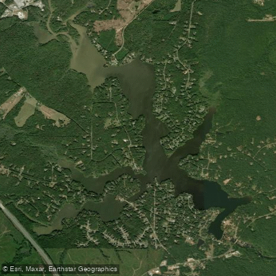
High Falls Lake
- Boat Ramps
- 2
- Access Points
- 2
- Campsites
- 0
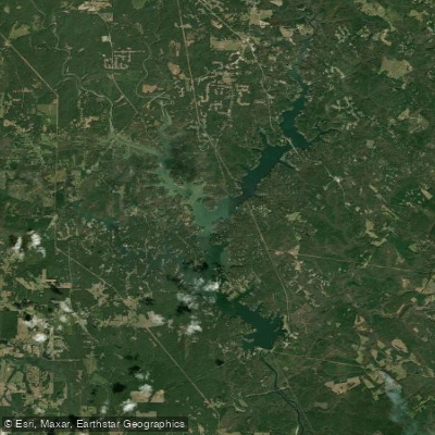
High Falls Lake is a 650-acre impoundment located in High Falls State Park, Georgia. The lake offers paddlers a scenic environment surrounded by lush forests, rocky cliffs, and the park's namesake waterfall. Kayak, canoe, and aqua cycle rentals are available from 8:30 am to 4:30 pm daily at the park office.
Paddlers can explore numerous coves and inlets around the lake's shoreline. Wildlife sightings may include deer, turtles, and various bird species. The lake is known for excellent fishing, particularly for hybrid and white bass.
A unique paddling experience is available via the park's Paddle-In Campsite. This primitive group site, accommodating up to 25 people, requires a 0.5-mile paddle from the park office to reach. It includes basic amenities like a pit privy, picnic tables, and a fire ring.
Safety considerations include following Georgia boating regulations and wearing proper life jackets. Motors over 10 hp are prohibited on the lake. Paddlers should be aware of the dam at the south end of the lake and avoid this area.
Facilities for paddlers include boat ramps, public boat docks, and fishing docks. The park also offers campsites, yurts, picnic areas, and hiking trails along the lakeshore and nearby Towaliga River.
High Falls State Park has historical significance. In the early 1800s, it was a prosperous industrial town with various businesses. The area declined after being bypassed by a major railroad in the 1880s. Remnants of this history, including a hydroelectric power plant foundation, can be seen along the river.
For a unique paddling destination, visitors can access a secluded peninsula on the northwestern edge of the lake, about a 30-minute paddle from the main park areas. This spot offers a more isolated experience for those seeking tranquility on the water.
Water access, boat ramps & amenities
Learn how to get on High Falls Lake. Uncover great paddling access points, boat ramps, and all the facilities you need for an unforgettable day on the water. Some locations shown may border or include private property. Always check property boundaries and applicable regulations before visiting. PaddleWays's Public & Private Land layer can help you plan your access with confidence.
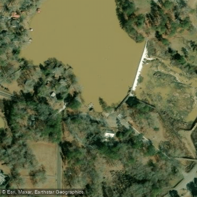
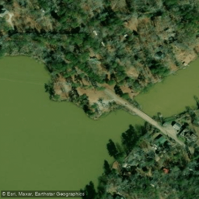
Paddle smarter with real-time insights
Whether you're en route and conditions shift or you're looking for the best spot based on current flows, we enable you to make informed decisions on the fly.








Find Places to Paddle

Over 400,000 Places to Paddle
Every user gets free access to launch points, boat ramps, and public property parcels.


Water and weather conditions (10 day forecast)
See the best times to paddle High Falls Lake and check the forecast before you go.
No forecast data available.
Paddling near High Falls Lake

Flint River
Ocmulgee River

Chattahoochee River
Lake Sinclair
Heads Creek Reservoir
Harbins Lake
Chief McIntosh Lake
Jackson Lake
Towaliga River
Explore Georgia waters
Top paddling waters
Popular Cities
Loading popular cities...
Explore near High Falls Lake
Access points
Nearby waters
More in Georgia

Smarter Paddling Starts in the App.
Paddleways gives you everything you need to plan smarter, paddle better, and own every trip from first launch to takeout.