Curated by PaddleWays
RouteFlatwater
- Distance
- 14 mi
- Paddle time
- 5.5 hrs
- Best for
- Beginners, families
- Put-in → take-out
- Crow River, Old Mill Park Public Water Access Site → Crow River, Lake Rebecca Regional Park Public Water Access Site
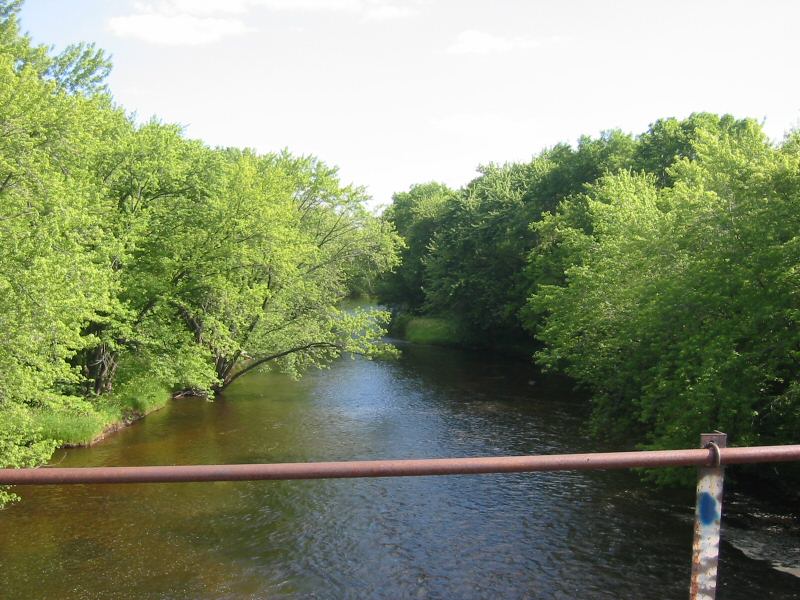
The South Fork Crow River is a gentle waterway that flows eastward across central Minnesota, originating at Little Kandiyohi Lake and traveling approximately 100 miles before joining the North Fork Crow River at Rockford to form the main stem of the Crow River. This river system is part of the larger Mississippi River watershed. The South Fork Crow offers excellent paddling opportunities for canoeists and kayakers of all skill levels, with its calm waters making it particularly suitable for beginners and families. The river is designated as a State Water Trail, providing multiple access points and amenities for paddlers. Popular sections include the 14.3-mile stretch from Watertown to Rockford and the 11-mile segment from Cedar Mills to Hutchinson.
Characterized by its flatwater nature, the South Fork Crow River presents minimal technical challenges, allowing for a peaceful and scenic journey through Minnesota's rural landscape. The river's difficulty remains consistent throughout its course, rarely exceeding Class I rapids even during higher water periods. Spring and early summer typically offer the best paddling conditions, with higher water levels and lush vegetation. However, the river remains navigable through fall, providing opportunities to witness the changing colors of the surrounding deciduous forests.
The river corridor supports a diverse ecosystem, home to various bird species, including bald eagles, herons, and waterfowl. Paddlers may also encounter deer, beavers, and other riparian wildlife. The surrounding landscape features a mix of agricultural fields, wooded areas, and occasional wetlands.
Key landmarks along the South Fork Crow include the historic town of Hutchinson, where paddlers can take advantage of the Luce Line State Trail for convenient bicycle shuttles. The river passes through several small communities, offering glimpses of rural Minnesota life. Primary access points include Rick Johnson Park in Watertown, Cedar Mills, Hutchinson, and Lake Rebecca Regional Park in Rockford. These locations provide convenient put-in and take-out options for day trips or longer expeditions.
The South Fork Crow River played a significant role in the early settlement and development of the region, supporting mills and small industries along its banks. Today, it serves as an important recreational resource and natural corridor through central Minnesota.
Paddlers should be aware of potential logjams and strainers, especially after high water events. It's advisable to check current river conditions and any local regulations before embarking on a trip. While most paddlers enjoy day excursions, the river's length and multiple access points allow for multi-day adventures for those seeking a more immersive experience.
The South Fork Crow River offers a serene paddling experience through the heart of Minnesota, providing an excellent opportunity to connect with nature and explore the state's waterways.
Curated routes
Hand-picked by the PaddleWays team, with put-ins, take-outs, paddle times and the hazards along the way.
RouteFlatwater
Hazards
No paddler has reported a hazard here yet, so these are the dams, falls and big rapids on our map. Hazards change with flows and storms, so check them before you launch.
From the community
Nobody has shared a trip on South Fork Crow River yet. Paddle it, then tell the next paddler how it went.
See exactly where the public can get on and off the river. Launch points and boat ramps are paired with PaddleWays' public land data so you know where you can legally land.
Public shoreline
2%of the river's shoreline is public
Most of the riverbank is private. Launch, land and camp only at public access points.
Flows, weather and a route-by-route verdict, so you know which stretch of the South Fork Crow River is worth paddling today.
No forecast data available.
Live flows, marked hazards and fresh trip reports from paddlers who were just on the water, all in one place.





Every user gets free access to launch points, boat ramps, and public property parcels.

Loading popular cities...
PaddleWays gives you everything you need to plan smarter, paddle better, and own every trip from first launch to takeout.