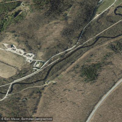
Curated by PaddleWays
RouteClass I
- Distance
- 2.4 mi
- Paddle time
- 2–3 hrs
- Best for
- Kayak, tube
- Put-in → take-out
- Arlington Tubing and Kayaking Section → Red Mill Boat Ramp
Rocks in the riverbed
The Batten Kill is a picturesque river that flows through southern Vermont and eastern New York, offering paddlers a serene journey through stunning landscapes. This 57-mile long waterway is renowned for its clear waters, gentle current, and scenic beauty, making it a popular destination for canoeists, kayakers, and anglers alike.
The river's paddling opportunities are diverse, with several notable sections catering to different preferences. The most popular stretch runs from Arlington, Vermont to Shushan, New York, covering approximately 26 miles in Vermont and 31 miles in New York. This section features Class I water, making it suitable for beginners and families while still offering enough variety to keep experienced paddlers engaged.
One of the most charming aspects of paddling the Batten Kill is the presence of covered bridges along its course. The West Arlington to Shushan section, often referred to as the "Arlington Covered Bridge Section," takes paddlers past four covered bridges, including the West Arlington, Eagleville, Shushan, and Jackson bridges. This 7.5-mile stretch is particularly popular, offering a perfect blend of natural beauty and historical charm.
The Batten Kill is primarily a Class I river, with consistent gentle rapids and occasional riffles. This makes it an excellent choice for novice paddlers and those seeking a relaxing day on the water. However, paddlers should still be aware of potential obstacles such as rocks in the riverbed, especially during lower water levels.
The best time to paddle the Batten Kill is typically from late spring through early fall. Spring often brings higher water levels, which can be ideal for paddling but may require more skill to navigate. Summer and early fall offer more stable conditions and are perfect for leisurely trips and swimming.
As you paddle the Batten Kill, you'll be treated to a diverse ecosystem. The river is famous for its trout fishing, with brown and rainbow trout abundant in its waters. Along the banks, you might spot various wildlife including deer, beavers, and a wide array of bird species. The surrounding landscape alternates between lush forests, open meadows, and picturesque farmland, providing a constantly changing backdrop for your journey.
Several towns along the Batten Kill offer convenient access points and services for paddlers. Arlington, Vermont serves as a popular starting point, with Cambridge, New York another key location along the river. These towns, along with others like Shushan and Greenwich in New York, provide opportunities for resupply, accommodation, and local charm.
The Batten Kill holds significant cultural and historical importance to the region. It has long been a vital resource for local communities, from powering mills in the past to supporting recreation and tourism today. The river's name is derived from Bartholomew's Kill, with "kill" being the Dutch word for creek or stream.
Safety on the Batten Kill is generally straightforward due to its gentle nature, but standard river precautions should always be observed. Wearing a personal flotation device is essential, and paddlers should be aware of changing weather conditions and water levels. It's also important to respect private property along the banks and follow Leave No Trace principles.
For those seeking a multi-day adventure, the full 57-mile journey from the headwaters to the confluence with the Hudson River can be an excellent option. This trip typically takes 3-4 days, allowing paddlers to fully immerse themselves in the river's changing character and the surrounding landscape.
Whether you're looking for a short, family-friendly float or an extended river journey, the Batten Kill offers a paddling experience that combines natural beauty, historical interest, and gentle adventure in equal measure.
Curated routes
Hand-picked by the PaddleWays team, with put-ins, take-outs, paddle times and the hazards along the way.
RouteClass I
RouteClass I
RouteClass I
Hazards
No paddler has reported a hazard here yet, so these are the dams, falls and big rapids on our map. Hazards change with flows and storms, so check them before you launch.
From the community
Real trips from PaddleWays paddlers: which route they ran, how the flows were, and what to watch for.
Loading trip reports
A S.
Raft •
553 cfs
Very relaxing tube float! Conditions were perfect with only a few short low spots
See exactly where the public can get on and off the river. Launch points and boat ramps are paired with PaddleWays' public land data so you know where you can legally land.
Public shoreline
15%of the river's shoreline is public
Most of the riverbank is private. Launch, land and camp only at public access points.
Flows, weather and a route-by-route verdict, so you know which stretch of the Batten Kill is worth paddling today.
No forecast data available.
Live flows, marked hazards and fresh trip reports from paddlers who were just on the water, all in one place.





Every user gets free access to launch points, boat ramps, and public property parcels.


Loading popular cities...
PaddleWays gives you everything you need to plan smarter, paddle better, and own every trip from first launch to takeout.