Keyhole Reservoir
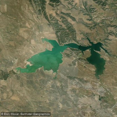
Keyhole Reservoir
- Boat Ramps
- 4
- Access Points
- 4
- Campsites
- 7
Keyhole Reservoir in northeastern Wyoming offers diverse paddling opportunities across its 9,300 acres and 53 miles of shoreline. The lake is located in Keyhole State Park, about 17 miles northeast of Moorcroft and easily accessed off I-90 at exit 165.
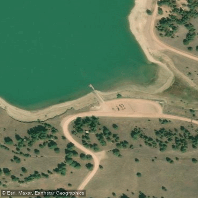
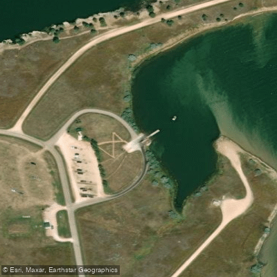
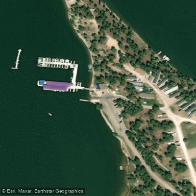
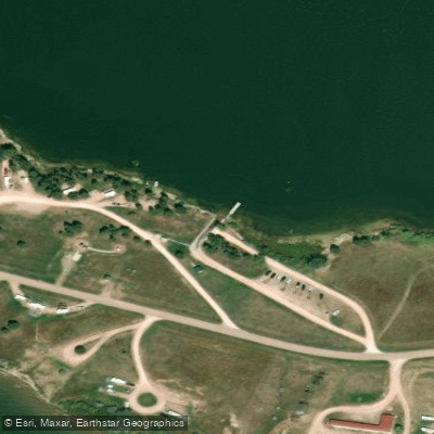
Paddlers can launch from five boat ramps around the lake, four of which have attached docks. The Keyhole Marina provides rentals for kayaks, canoes, and paddleboards during its seasonal operation from May 1 to September 30. Swimming is permitted anywhere on the lake except near boat ramps and the marina, with a designated beach area south of the marina.
The reservoir supports a variety of fish species including walleye, bass, northern pike, crappie, and catfish. Fishing is allowed year-round with a valid license, though it's prohibited from boat docks. Ice fishing is popular in winter when the lake freezes over.
Wildlife viewing opportunities abound, with over 225 bird species in the area. Paddlers may spot white pelicans, ospreys, and bald eagles depending on the season. Mule deer, white-tailed deer, and antelope are commonly seen along the shoreline.
Ten campgrounds with 286 sites surround the lake, providing convenient overnight options for multi-day paddling trips. Amenities include picnic areas, a trailer dump station, and hiking trails. The Keyhole Marina offers additional services like a snack bar, general store, and campsites with hookups.
While specific paddling routes aren't outlined, the lake's numerous inlets and coves provide ample exploration opportunities. The eastern inlet offers a more secluded paddling experience and shelter on windy days. Paddlers should be aware that the water can be quite shallow in some areas.
Water access, boat ramps & amenities
Learn how to get on Keyhole Reservoir. Uncover great paddling access points, boat ramps, and all the facilities you need for an unforgettable day on the water. Some locations shown may border or include private property. Always check property boundaries and applicable regulations before visiting. PaddleWays's Public & Private Land layer can help you plan your access with confidence.
Paddle smarter with real-time insights
Whether you're en route and conditions shift or you're looking for the best spot based on current flows, we enable you to make informed decisions on the fly.








Find Places to Paddle

Over 400,000 Places to Paddle
Every user gets free access to launch points, boat ramps, and public property parcels.


Water and weather conditions (10 day forecast)
See the best times to paddle Keyhole Reservoir and check the forecast before you go.
Keyhole Reservoir and Dam
Explore Wyoming waters
Top paddling waters
Popular Cities
Loading popular cities...
Explore near Keyhole Reservoir
Access points
- Keyhole Reservoir Boat Ramp
- Keyhole Reservoir Boat Ramp
- Keyhole Marina Boat Ramp
- Keyhole State Park Boat Ramp
- Keyhole State Park Campground
- Keyhole State Park Campground
- Keyhole State Park Campground
- Keyhole State Park Campground
- Keyhole State Park Campground
- Keyhole State Park Campground
- Keyhole State Park Campground
Nearby waters
More in Wyoming

Smarter Paddling Starts in the App.
Paddleways gives you everything you need to plan smarter, paddle better, and own every trip from first launch to takeout.