Alviso Slough
- Saltwater
- Sea area
Alviso Slough
- Saltwater
- Sea area
- Sq. miles
- 0.1
- Boat Ramps
- 1
- Access Points
- 0
- Campsites
- 0
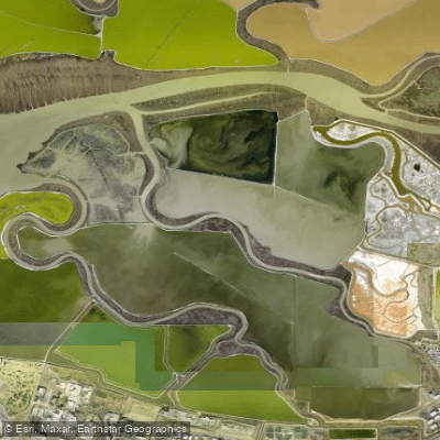
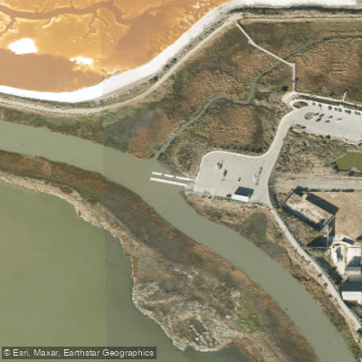
Alviso Slough is a tidal saltwater channel extending approximately four miles from the community of Alviso to the open waters of the south San Francisco Bay. The primary and only identified launch point for paddlers is Alviso Marina County Park, located at Mill Street in Alviso. This facility offers two concrete boat launch ramps and two floating docks, one of which is a low-freeboard dock well-suited for kayaks and stand-up paddleboards. Parking is free with no time limits, and the park is open from 8:00 a.m. to sunset, with automatic gates that close at dark. Tidal influence is the dominant hydrological feature, with a typical range of 9 to 10 feet and currents running approximately 1.5 mph. Paddlers must plan trips around these tides; a common strategy is to launch an hour before low tide to get a current boost both outbound and inbound on a return trip. The slough is bounded by levees, providing a mostly enclosed, calm-water experience until reaching the bay. Powerboat traffic increases on higher tides, but is otherwise minimal. Navigating upstream from the marina leads under several bridges, with navigable water typically ending around the Highway 237 bridge about a mile away, except during very high tides over 8 feet when more reed-lined channels may be explored. Paddling downstream leads toward San Francisco Bay, which is a more exposed, open-water environment. The slough passes through the salt marshes of the Don Edwards San Francisco Bay National Wildlife Refuge, offering opportunities to see shorebirds and occasional harbor seals, with wildlife viewing often better at lower tides. The waterway is a good first paddle for beginners due to its generally calm conditions, though venturing into the bay requires experience appropriate for open, tidal salt water. The surrounding landscape is characterized by salt ponds and marshes, with historical remnants like old salt hardpan visible in some areas.
Water access, boat ramps & amenities
Learn how to get on Alviso Slough. Uncover great paddling access points, boat ramps, and all the facilities you need for an unforgettable day on the water. Some locations shown may border or include private property. Always check property boundaries and applicable regulations before visiting. PaddleWays's Public & Private Land layer can help you plan your access with confidence.
Paddle smarter with real-time insights
Whether you're en route and conditions shift or you're looking for the best spot based on current flows, we enable you to make informed decisions on the fly.








Find Places to Paddle

Over 400,000 Places to Paddle
Every user gets free access to launch points, boat ramps, and public property parcels.


Tides, wind & water conditions (10 day forecast)
On open water, wind and tide matter as much as the weather. See the best times to paddle Alviso Slough and check the marine forecast before you launch.
Loading tide predictions…
Paddling near Alviso Slough

San Joaquin River

Sacramento River

San Francisco Bay

Stanislaus River

Tuolumne River
Mayfield Slough

Mokelumne River
Calaveras Reservoir
San Antonio Reservoir
Explore California waters
Top paddling waters
Popular Cities
Loading popular cities...
Explore near Alviso Slough
Access points
- Alviso Marina County Park Boat Ramp
- Guadalupe River Bridge
- Guadalupe River Bridge
- San Tomas Aquino Creek Bridge
- San Tomas Aquino Creek Bridge
- San Tomas Aquino Creek Bridge
- Calabazas Creek Trail Bridge
- San Tomas Aquino Creek Bridge
- San Tomas Aquino Creek Bridge
- San Tomas Aquino Creek Bridge
- Calabazas Creek Bridge
- San Tomas Aquino Creek Bridge
- All 59 spots
Nearby waters
More in California

Smarter Paddling Starts in the App.
Paddleways gives you everything you need to plan smarter, paddle better, and own every trip from first launch to takeout.