Curated by PaddleWays
RouteClass I–II
- Distance
- 6.5 mi
- Paddle time
- ~2 hrs
- Put-in → take-out
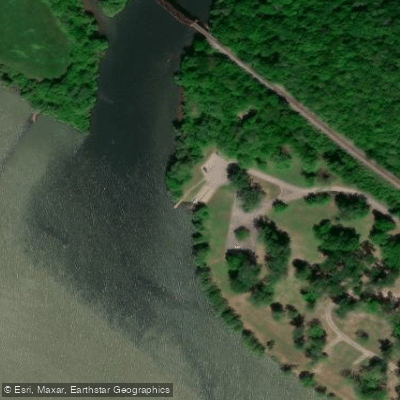
- Weber Creek Road Access → Lee Creek Reservoir Boat Ramp
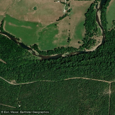
Lee Creek originates in the Boston Mountains of Washington County, Arkansas, flowing generally southwest through Crawford County before crossing into Sequoyah County, Oklahoma. The creek then loops back into Arkansas near Natural Dam in Crawford County, ultimately joining the Arkansas River near Van Buren after traveling approximately 64 miles through rugged Ozark terrain. The creek carves through limestone and sandstone formations, creating distinctive bluffs, rock outcroppings, and natural features that define its character. Lee Creek Reservoir, formed by a dam near the confluence with the Arkansas River, serves as the drinking water source for Fort Smith and surrounding communities, supporting a population of approximately 200,000.
Paddling opportunities on Lee Creek vary significantly by section and season. The upper reaches from Devil's Den State Park to Highway 220 offer Class II-III whitewater during periods of adequate flow, featuring technical boulder gardens, narrow channels, and ledge drops including the notable "El Horrendo" rapid. This 8.4-mile section demands intermediate to advanced skills, with tight maneuvering through rock gardens and strong hydraulics at higher flows. Downstream from Highway 220 to Natural Dam, the creek mellows to Class II+ over approximately 3 miles, suitable for paddlers with basic whitewater experience. Lee Creek is highly flow-dependent, running best after significant rainfall events, typically from late fall through spring. Summer flows often become too low for practical paddling, requiring extensive portaging. The creek's flashy nature means water levels can rise and fall rapidly—a characteristic of Boston Mountain streams draining steep, well-drained terrain.
The riparian corridor supports diverse Ozark forest communities including oak, hickory, elm, and pecan along the banks. Wildlife sightings may include white-tailed deer, raccoons, mink, and various fish species including smallmouth bass, which thrive in the creek's clear, rocky pools. Natural Dam, located where Highway 59 crosses the creek, represents one of the most significant landmarks—a natural rock formation creating a scenic waterfall feature. Devil's Den State Park provides developed access to the upper watershed with Civilian Conservation Corps-era structures and extensive trail systems.
Primary access points include Devil's Den State Park (Washington County), Highway 220 bridge (Crawford County), Natural Dam area on Highway 59 (Crawford County), and Lee Creek Reservoir Recreation Area near Van Buren (Crawford County). The nearest significant towns are West Fork, Cedarville, and Van Buren in Arkansas, and Short in Oklahoma.
The creek holds designation as an Oklahoma Scenic River for portions in Sequoyah County and as an Arkansas Extraordinary Resource Water upstream of the Oklahoma border, reflecting its exceptional water quality. Arkansas has designated the watershed as a nutrient surplus area, placing controls on fertilizer applications to protect water quality.
Safety considerations include the creek's unpredictable flow regime, numerous strainers and deadfall in the narrow channel, and technical rapids requiring scouting. Commercial outfitters do not typically operate on Lee Creek, requiring self-sufficient trip planning and private shuttle arrangements.
Curated routes
Hand-picked by the PaddleWays team, with put-ins, take-outs, paddle times and the hazards along the way.
RouteClass I–II
RouteClass II–III
RouteClass II–III
Hazards
No paddler has reported a hazard here yet, so these are the dams, falls and big rapids on our map. Hazards change with flows and storms, so check them before you launch.
From the community
Real trips from PaddleWays paddlers: which route they ran, how the flows were, and what to watch for.
Loading trip reports
Hillbilly B.
996 cfs at Short
Fun float for the whole family, about a 4 hour trip. 1 nice waterfall to play and swim
See exactly where the public can get on and off the river. Launch points and boat ramps are paired with PaddleWays' public land data so you know where you can legally land.
Public shoreline
20%of the river's shoreline is public
Most of the riverbank is private. Launch, land and camp only at public access points.
Flows, weather and a route-by-route verdict, so you know which stretch of the Lee Creek is worth paddling today.
All Flow Stations
Live flows, marked hazards and fresh trip reports from paddlers who were just on the water, all in one place.





Every user gets free access to launch points, boat ramps, and public property parcels.
Loading popular cities...
PaddleWays gives you everything you need to plan smarter, paddle better, and own every trip from first launch to takeout.