Curated by PaddleWays
RouteClass I–II
- Distance
- 16.8 mi
- Paddle time
- ~5.5 hrs
- Best for
- Kayak, canoe
- Put-in → take-out
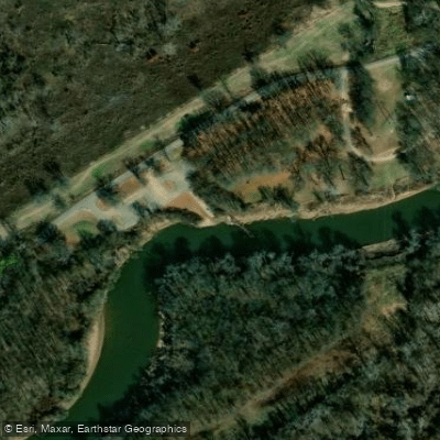
- East Gordon Boat Ramp → Point Remove Boat Ramp
Point Remove Creek is a scenic waterway located in Conway County, Arkansas. This tributary of the Arkansas River originates in the northern part of the county and flows southward for approximately 30 miles before joining the Arkansas River near Morrilton. The creek's unusual name is derive from the French word remous, meaning eddy or whirlpool, likely referring to turbulent water features at its confluence.
Point Remove Creek offers some opportunities for canoeing and kayaking, particularly after periods of rainfall. The creek winds through a picturesque landscape bordered by trees, creating a serene paddling environment. Water levels can fluctuate significantly based on recent precipitation, so paddlers should check conditions before planning a trip.
The difficulty of paddling Point Remove Creek is estimated to be Class I-II, suitable for beginner to intermediate paddlers. However, obstacles like fallen trees may be present and require basic maneuvering skills. The best times for paddling are typically in spring and early summer when water levels are higher.
The creek's ecosystem supports a variety of riparian flora and fauna typical of central Arkansas waterways. Paddlers may encounter wildlife such as herons, turtles, and various fish species. The surrounding landscape features a mix of hardwood forests and occasional clearings.
Access points for Point Remove Creek are limited. Paddlers likely put in at unspecified locations in Conway County, with potential take-out points near the creek's confluence with the Arkansas River. The nearby town of Morrilton serves as the primary reference point for those exploring the creek.
Historically, Point Remove Creek played a role in early Arkansas settlement and transportation. The creek's junction with the Arkansas River was an important landmark in the 1820s, referenced in treaties defining Cherokee territory boundaries in the region.
When paddling Point Remove Creek, safety considerations include checking water levels, being prepared for potential logjams or strainers, and respecting private property along the banks. As with all Arkansas waterways, life jackets are required for each paddler.
While multi-day trips are not common on Point Remove Creek due to its relatively short length, the creek could potentially be incorporated into longer Arkansas River paddling itineraries for experienced paddlers seeking to explore this lesser-known tributary.
Curated routes
Hand-picked by the PaddleWays team, with put-ins, take-outs, paddle times and the hazards along the way.
RouteClass I–II
Hazards
No hazards are marked on Point Remove Creek yet. That is not the same as none being there: if you find one, report it for the next paddler.
From the community
Nobody has shared a trip on Point Remove Creek yet. Paddle it, then tell the next paddler how it went.
See exactly where the public can get on and off the river. Launch points and boat ramps are paired with PaddleWays' public land data so you know where you can legally land.
Public shoreline
4%of the river's shoreline is public
Most of the riverbank is private. Launch, land and camp only at public access points.
Flows, weather and a route-by-route verdict, so you know which stretch of the Point Remove Creek is worth paddling today.
No forecast data available.
Live flows, marked hazards and fresh trip reports from paddlers who were just on the water, all in one place.





Every user gets free access to launch points, boat ramps, and public property parcels.

Loading popular cities...
PaddleWays gives you everything you need to plan smarter, paddle better, and own every trip from first launch to takeout.