Curated by PaddleWays
RouteClass II
- Distance
- 3.3 mi
- Paddle time
- 4 hrs
- Best for
- Kayak
- Put-in → take-out
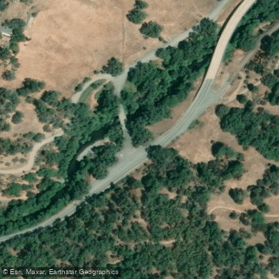
- Potter Valley Road Access → Lake Mendocino Recreation Park Boat Ramp
Class V+ rapid Three Rock Falls to avoid
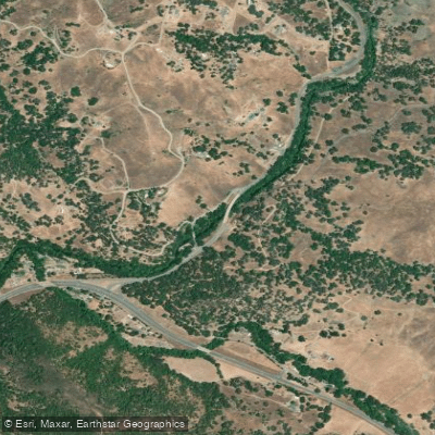
The East Fork Russian River originates in the northern end of Potter Valley in Mendocino County, California. This 15-mile long tributary flows south through a canyon before entering Coyote Valley, which is now filled by Lake Mendocino. The East Fork joins the main stem of the Russian River just below Coyote Dam.
Paddling opportunities on the East Fork are limited but rewarding. The most popular run is a 2.6-mile stretch from below Three Rock Falls to just above Lake Mendocino. This section offers Class II+ rapids with some Class III features, making it suitable for intermediate paddlers. The run typically takes about half a day to complete. The difficulty ranges from Class II to III, with one notable Class V+ rapid called Three Rock Falls that should be portaged. Paddlers should have solid whitewater skills and be comfortable reading rapids.
The recommended flow for kayaks is 300-600 cfs. Due to dam releases, this run is good year-round but especially in autumn. Paddlers can check real-time water flow data from USGS gauges on the East Fork near Calpella and Ukiah to plan trips.
The river corridor supports diverse wildlife, including ospreys, bald eagles, kingfishers, great blue herons, turtles, and river otters. The surrounding landscape transitions from the oak woodlands and grasslands of Potter Valley to the more mountainous terrain near Lake Mendocino.
Key landmarks include Three Rock Falls, the first bridge where Potter Valley Road crosses the river, and Lake Mendocino itself. The town of Potter Valley provides the nearest access point for the upper section, while Ukiah is the closest city to the lower reaches.
Primary put-in options are either at the first Potter Valley Road bridge or about a mile downstream just below Three Rock Falls. The take-out is located just above Lake Mendocino. Shuttle distance is approximately 3 miles.
Historically, the East Fork has played a crucial role in local agriculture, with its waters used to irrigate alfalfa, grapes, and rice in Potter Valley. The river is part of the Potter Valley Project, an early 20th-century hydroelectric initiative that diverts water from the Eel River basin into the Russian River watershed.
Safety considerations include scouting Three Rock Falls and being aware of changing water levels due to dam releases. As with all California rivers, a valid fishing license is required for anglers. While the East Fork itself doesn't offer multi-day trip options, it can be combined with runs on the main stem Russian River for extended paddling adventures through the heart of Mendocino County's wine country.
Curated routes
Hand-picked by the PaddleWays team, with put-ins, take-outs, paddle times and the hazards along the way.
RouteClass II
Hazards
Reported by paddlers. Hazards change with flows and storms, so check them before you launch.
Strainer
Log across river channel.
From the community
Nobody has shared a trip on East Fork Russian River yet. Paddle it, then tell the next paddler how it went.
See exactly where the public can get on and off the river. Launch points and boat ramps are paired with PaddleWays' public land data so you know where you can legally land.
Public shoreline
0%of the river's shoreline is public
Most of the riverbank is private. Launch, land and camp only at public access points.
Flows, weather and a route-by-route verdict, so you know which stretch of the East Fork Russian River is worth paddling today.
All Flow Stations
Live flows, marked hazards and fresh trip reports from paddlers who were just on the water, all in one place.





Every user gets free access to launch points, boat ramps, and public property parcels.
Loading popular cities...
PaddleWays gives you everything you need to plan smarter, paddle better, and own every trip from first launch to takeout.