Dorchester Bay
- Saltwater
- Bay
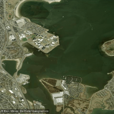
Dorchester Bay
- Saltwater
- Bay
- Sq. miles
- 1.1
- Boat Ramps
- 0
- Access Points
- 0
- Campsites
- 0
Dorchester Bay is a coastal bay in Boston, Massachusetts, providing access to the outer harbor and islands. It is a saltwater environment with significant exposure to wind and waves, requiring careful planning. The primary access points for paddlers include the Morrissey Boulevard Boat Ramp, though its operational status has been subject to closure and restrictions, including being closed from dusk to dawn. Victory Park on Victory Road offers another put-in via a footbridge, with limited parking for a few vehicles, providing entry to both the Neponset River and Dorchester Bay. Carson Beach in South Boston has also been used as a launch point, though it is an exposed beach with no formal ramp. The bay opens to Boston Harbor, offering routes to nearby islands like Thompson Island and Spectacle Island, though these crossings involve open water.
Paddling conditions are heavily influenced by weather. The bay is known for strong southwest winds that can quickly create choppy seas and overwhelming conditions, as evidenced by multiple rescues. Water temperatures can be extremely cold, reported at around 40 degrees Fahrenheit in late winter and early spring, posing a severe risk of hypothermia. The area experiences significant boat traffic, and paddlers will encounter navigational buoys. There is no mention of a significant surf zone at the beach entries, but wind-driven waves are a major hazard. Paddlers must check marine forecasts thoroughly, including for later in the day, and be prepared for changing conditions. The aesthetic is urban coastal, with views of the city skyline, the John F. Kennedy Library, and industrial infrastructure. Wildlife and natural features are not detailed. There are no specific regulations mentioned beyond potential launch site closures and time restrictions. The overall character is that of a challenging, exposed urban bay suitable only for experienced paddlers with proper preparation and safety gear, particularly given the cold water and potential for rapid weather deterioration.
Water access, boat ramps & amenities
Learn how to get on Dorchester Bay. Uncover great paddling access points, boat ramps, and all the facilities you need for an unforgettable day on the water. Some locations shown may border or include private property. Always check property boundaries and applicable regulations before visiting. PaddleWays's Public & Private Land layer can help you plan your access with confidence.
Paddle smarter with real-time insights
Whether you're en route and conditions shift or you're looking for the best spot based on current flows, we enable you to make informed decisions on the fly.








Find Places to Paddle

Over 400,000 Places to Paddle
Every user gets free access to launch points, boat ramps, and public property parcels.


Tides, wind & water conditions (10 day forecast)
On open water, wind and tide matter as much as the weather. See the best times to paddle Dorchester Bay and check the marine forecast before you launch.
Loading tide predictions…
Paddling near Dorchester Bay

Charles River

Concord River

Massachusetts Bay

Merrimack River

Sudbury River

Broad Sound

Wachusett Reservoir

Assabet River
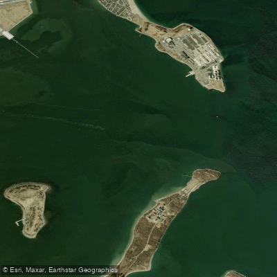
President Roads
Ipswich River
Explore Massachusetts waters
Top paddling waters
Popular Cities
Loading popular cities...
Explore near Dorchester Bay
Access points
- Tr Red High Speed Ln Bridge
- Tr Red Line Ssh Bridge
- Comb St3/st28 & Charles Bridge
- Water Neponset River Bridge
- Comb Ramp Lt& Millers R Bridge
- Comb Strw Dr & Chas Riv Bridge
- Water Pine Tree Brook Bridge
- Tr Green Line D Bridge
- Tr Green Line D Bridge
- I 93 /us1/st3 Bridge
- Rr Csx Bridge
- Boston University Bridge
- All 15 spots
Nearby waters
More in Massachusetts

Smarter Paddling Starts in the App.
Paddleways gives you everything you need to plan smarter, paddle better, and own every trip from first launch to takeout.