Hingham Bay
- Saltwater
- Bay
Hingham Bay
- Saltwater
- Bay
- Sq. miles
- 3.9
- Boat Ramps
- 0
- Access Points
- 0
- Campsites
- 0
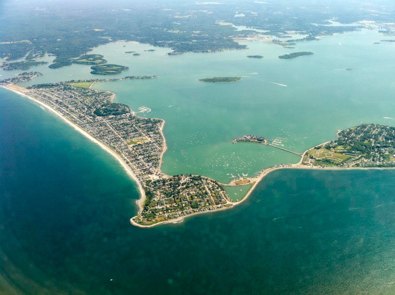
Hingham Bay is a large, shallow, and well-protected saltwater bay within Boston Harbor, offering beginner-friendly paddling conditions. The primary and most recommended public access point is the Hingham Town Ramp and adjacent Bathing Beach on Summer Street (Route 3A). Kayaks and SUPs can launch directly from the sandy beach in front of the parking area. This launch is highly tide-dependent, as Hingham Harbor becomes a large mudflat at low tide, making launching and landing a mucky affair. The best launch times are between mid-tide and high tide. Parking is free and open to the public, with no town residency restrictions, though spaces fill quickly, especially on summer weekends. There are no public restrooms reliably available at the launch site. The bay's geography provides extensive shelter, making it a recommended first trip for those new to harbor kayaking. The water is consistently calm with no significant wave hazards expected, though paddlers should watch for recreational boat traffic, particularly near the beach and marina areas on busy days. Tidal influence is moderate and predictable, with a flood tide of roughly four hours and an ebb of eight hours each cycle, which should be factored into trip planning. The bay bottom is primarily sand and mud, avoiding rocky hazards. Key destinations for exploration from this launch include the nearby World's End peninsula, the Weir River, and the islands within Hingham Bay, such as Bumpkin and Grape Island. The area is not suitable for open-water crossings to more exposed islands like Lovells Island due to unprotected fetch, proximity to major shipping lanes, and strong currents elsewhere in the harbor. The best paddling season runs from March through November, with peak conditions in late spring and early fall. Water temperatures drop significantly in winter, requiring appropriate cold-water gear.
Water access, boat ramps & amenities
Learn how to get on Hingham Bay. Uncover great paddling access points, boat ramps, and all the facilities you need for an unforgettable day on the water. Some locations shown may border or include private property. Always check property boundaries and applicable regulations before visiting. PaddleWays's Public & Private Land layer can help you plan your access with confidence.
Paddle smarter with real-time insights
Whether you're en route and conditions shift or you're looking for the best spot based on current flows, we enable you to make informed decisions on the fly.








Find Places to Paddle

Over 400,000 Places to Paddle
Every user gets free access to launch points, boat ramps, and public property parcels.


Tides, wind & water conditions (10 day forecast)
On open water, wind and tide matter as much as the weather. See the best times to paddle Hingham Bay and check the marine forecast before you launch.
Loading tide predictions…
Paddling near Hingham Bay

Taunton River

Charles River

Massachusetts Bay

Concord River

Merrimack River

Broad Sound

Sudbury River

Assabet River
Ipswich River
Explore Massachusetts waters
Top paddling waters
Popular Cities
Loading popular cities...
Explore near Hingham Bay
Nearby waters
More in Massachusetts

Smarter Paddling Starts in the App.
Paddleways gives you everything you need to plan smarter, paddle better, and own every trip from first launch to takeout.