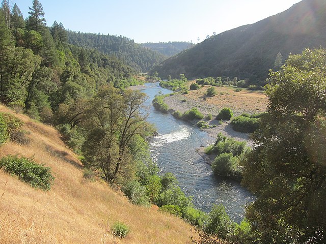
The North Fork American River is a wild and scenic waterway in Northern California, originating high in the Sierra Nevada mountains near Lake Tahoe. It flows southwest for approximately 60 miles before joining the Middle Fork to form the main stem of the American River. The river carves through a deep, rugged canyon, creating some of California's most challenging and beautiful whitewater. Paddling opportunities on the North Fork are primarily concentrated in the lower sections, with the most popular runs being the Chamberlain Falls section and the longer Iowa Hill Bridge to Ponderosa Bridge stretch.
The river offers a range of difficulties from Class II to Class V, with the most intense rapids found in the upper sections. The Chamberlain Falls run, a 5-mile stretch from Iowa Hill Bridge to Yankee Jims Road, is considered a classic Class IV-V whitewater adventure. It features notable rapids such as Slaughter's Sluice, Chamberlain Falls, Staircase Rapids, and Achilles' Heel. For those seeking a longer challenge, the 9-mile run from Iowa Hill Bridge to Ponderosa Bridge offers additional whitewater and scenery.
The North Fork is primarily a spring-fed river with no upstream dams, making it truly wild and subject to natural flow variations. The best paddling season is typically from late winter through spring, depending on snowmelt and rainfall. Flows above 2,000 cfs significantly increase the difficulty and continuity of rapids.
The river canyon is home to diverse flora and fauna, including oak woodlands, ponderosa pines, and various wildlife species adapted to the rugged terrain. The deep-walled canyon provides a dramatic backdrop for paddlers, with steep granite cliffs and lush vegetation lining the banks.
Access to the river is primarily via Iowa Hill Bridge near Colfax, CA, which serves as the main put-in for most runs. Take-out points include Yankee Jims Road and Ponderosa Bridge, depending on the chosen section. The nearby towns of Colfax and Auburn serve as bases for river trips.
Safety is paramount on the North Fork, as its remote nature and challenging rapids demand respect and skill. Paddlers should be experienced in Class IV-V whitewater and prepared for self-rescue scenarios. It's advisable to scout rapids, especially at higher flows, and be aware of changing conditions.
While primarily a day-trip destination, multi-day adventures are possible for those continuing downstream to Lake Clementine or combining runs on different forks of the American River system.
The North Fork American River holds significant cultural and historical value, having played a role in California's Gold Rush era. Today, it stands as a testament to the state's commitment to preserving wild rivers and offers outdoor enthusiasts a thrilling glimpse into the raw power and beauty of California's waterways.