Hull Bay
- Saltwater
- Bay
Hull Bay
- Saltwater
- Bay
- Sq. miles
- 1.5
- Boat Ramps
- 0
- Access Points
- 0
- Campsites
- 0
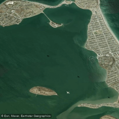
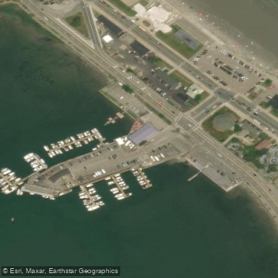
Hull Bay is a coastal bay on the north side of St. Thomas, U.S. Virgin Islands, known for its laid-back, local atmosphere distinct from the island's more tourist-centric beaches. The bay is home to one of the island's few public boat launches, providing a primary and convenient access point for paddlers to put in and take out. This launch area can become busy, and the parking lot fills up quickly. The bay features a mooring field for local boats, creating a distinctive scene and a potential navigational consideration for paddlers who may weave through the buoy field. The shoreline is a mix of sand and pebbles, with rocky points flanking the edges of the bay. These rocky areas are noted for snorkeling, indicating interesting underwater terrain to paddle over. The overall water conditions are influenced by its north-facing exposure to the Atlantic Ocean; it is recognized as the best spot on St. Thomas for surfing when waves are up, which directly implies that paddlers, especially those on stand-up paddleboards or surfskis, can encounter significant wave energy and should be prepared for a surf zone at the beach entry. The presence of consistent boat traffic from the launch and moored vessels necessitates vigilance, particularly when crossing near the ramp. Amenities for paddlers are available directly adjacent to the beach, including gear rentals for kayaks and stand-up paddleboards from local operators, as well as restaurants and bars for post-paddle refreshments. The vibe is authentically local and relaxed on weekdays, becoming more active with live music and gatherings on weekends.
Water access, boat ramps & amenities
Learn how to get on Hull Bay. Uncover great paddling access points, boat ramps, and all the facilities you need for an unforgettable day on the water. Some locations shown may border or include private property. Always check property boundaries and applicable regulations before visiting. PaddleWays's Public & Private Land layer can help you plan your access with confidence.
Paddle smarter with real-time insights
Whether you're en route and conditions shift or you're looking for the best spot based on current flows, we enable you to make informed decisions on the fly.








Find Places to Paddle

Over 400,000 Places to Paddle
Every user gets free access to launch points, boat ramps, and public property parcels.


Tides, wind & water conditions (10 day forecast)
On open water, wind and tide matter as much as the weather. See the best times to paddle Hull Bay and check the marine forecast before you launch.
Loading tide predictions…
Paddling near Hull Bay

Taunton River

Charles River

Massachusetts Bay

Concord River

Merrimack River

Broad Sound

Sudbury River

Assabet River
Hingham Bay
Ipswich River
Explore Massachusetts waters
Top paddling waters
Popular Cities
Loading popular cities...
Explore near Hull Bay

Smarter Paddling Starts in the App.
Paddleways gives you everything you need to plan smarter, paddle better, and own every trip from first launch to takeout.